Fort Campbell North geodata
Fort Campbell North (Kentucky) is a populated place; located in United States in America/Chicago (GMT-5) time zone. With population of 13,685 people, there are 3511 cities with bigger population in this country. Compared to other cities in United States, 67.5% of cities are located further ↑North; 50.7% of cities are located further →East and 57.8% of cities have higher elevation than Fort Campbell North. Note1


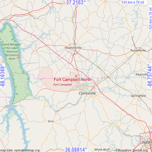
Fort Campbell North GPS coordinates[2]
36° 39' 15.444" North, 87° 27' 38.016" West
| Map corner | latitude | longitude |
|---|---|---|
| Upper-left | 37.2163°, | -88.16369° |
| Center: | 36.65429°, | -87.46056° |
| Lower-right: | 36.08814°, | -86.75744° |
| Map W x H: | 125.4×125.4 km | = 77.9×77.9mi |
| max Lat: | 71.29058° ⇑67.5% North |
| Fort Campbell North: | 36.65429° |
| min Lat: | ⇓32.5% South 19.06759° |
| min Long | Fort Campbell N | max Long |
| -171.73463° | -87.46056° | -66.98998° |
| W 49.3%⇐ | ⇒50.7% E |
Elevation
Elevation of Fort Campbell North is 166 m = 545 ft, and this is 128.8 m = 423 ft below average elevation for this country.
| Max E: |
3189 m = 10463 ft | 57.8% |
| Avg. | 294.8 m = 967 ft | |
| Fort Campbell North | 166 m = 545 ft | |
Min E: |
-60 m = -197 ft | 42.2% |
See also: United States elevation on elevation.city.
Geographical zone
Fort Campbell North is located in North temperate zone (between Tropic of Cancer and the Arctic Circle). Distance of this Northern Tropic circle is 1469.7 km =913.2 mi to South.| Distance of | km | miles | from Fort Campbell North |
|---|---|---|---|
| North Pole | 5931.5 | 3685.7 | to North |
| Arctic Circle | 3325.6 | 2066.4 | to North |
| Tropic Cancer | 1469.7 | 913.2 | to South |
| Equator | 4075.6 | 2532.5 | to South |


Nearby cities:
15 places around Fort Campbell North: (largest is in red/bold)
• Adams
36.1 km =22.4 mi,  102°
102°
• Cadiz
40.8 km =25.4 mi,  305°
305°
• Clarksville
16.5 km =10.3 mi,  146°
146°
• Coopertown
50.2 km =31.2 mi,  118°
118°
• Crofton
43.8 km =27.2 mi,  357°
357°
• Dover
38.5 km =23.9 mi,  241°
241°
• Elkton
32.3 km =20.1 mi,  57°
57°
• Erin
42.8 km =26.6 mi,  209°
209°
• Guthrie
26.2 km =16.3 mi,  91°
91°
• Hopkinsville
23.7 km =14.7 mi,  353°
353°
• Oak Grove
2 km =1.2 mi,  52°
52°
• Pembroke
16.4 km =10.2 mi,  34°
34°
• Pleasant View
47.7 km =29.6 mi,  127°
127°
• Springfield
53.9 km =33.5 mi,  107°
107°
• Tennessee Ridge
47.2 km =29.3 mi,  216°
216°
Sources, notices
• [Note1] Compared only with cities in United States existing in our database
• [Src1] Map data: © OpenStreetMap contributors (CC-BY-SA)
• [Src2] Other city data from geonames.org with taken over terms of usage.
• [Src3] Geographical zone / Annual Mean Temperature by Robert A. Rohde @ Wikipedia
