Young geodata
Young (Río Negro) is a populated place; located in Uruguay in America/Montevideo (GMT-3) time zone. With population of 15,924 people, there are 28 cities with bigger population in this country. Compared to other cities in Uruguay, 79.5% of cities are located further ↓South; 85.2% of cities are located further →East and 69.7% of cities have lower elevation than Young. Note1


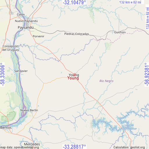
Young GPS coordinates[2]
32° 41' 54.384" South, 57° 37' 36.948" West
| Map corner | latitude | longitude |
|---|---|---|
| Upper-left | -32.10479°, | -58.33006° |
| Center: | -32.69844°, | -57.62693° |
| Lower-right: | -33.28817°, | -56.92381° |
| Map W x H: | 131.6×131.6 km | = 81.8×81.8mi |
| max Lat: | -30.25966° ⇑20.5% North |
| Young: | -32.69844° |
| min Lat: | ⇓79.5% South -34.94747° |
| min Long | Young | max Long |
| -58.41176° | -57.62693° | -53.38583° |
| W 14.8%⇐ | ⇒85.2% E |
Elevation
Elevation of Young is 86 m = 282 ft, and this is 15.4 m = 51 ft above average elevation for this country.
| Max E: |
294 m = 965 ft | 30.3% |
| Young | 86 m 282 ft | |
| Avg. | 70.6 m = 232 ft | |
Min E: |
2 m = 7 ft | 69.7% |
See also: Uruguay elevation on elevation.city.
Geographical zone
Young is located in South temperate zone (between Tropic of Capricorn and the Antarctic Circle). Distance of this Southern Tropic circle is 1029.8 km =639.9 mi to North.| Distance of | km | miles | from Young |
|---|---|---|---|
| Equator | 3635.7 | 2259.1 | to North |
| Tropic Capricorn | 1029.8 | 639.9 | to North |
| Antarctic Circle | 3765.4 | 2339.7 | to South |
| South Pole | 6371.3 | 3958.9 | to South |


Nearby cities:
15 places around Young: (largest is in red/bold)
• Dolores
107.6 km =66.9 mi,  210°
210°
• Estación Porvenir
42.2 km =26.2 mi,  329°
329°
• Fray Bentos
79 km =49.1 mi,  233°
233°
• Guichón
55.2 km =34.3 mi,  46°
46°
• José Enrique Rodó
111.3 km =69.2 mi,  175°
175°
• Mercedes
72.2 km =44.9 mi, 211°
• Nuevo Berlín
51 km =31.7 mi, 232°
• Palmitas
91.4 km =56.8 mi,  190°
190°
• Paso de los Toros
104.6 km =65 mi,  97°
97°
• Paysandú
60.1 km =37.3 mi,  314°
314°
• Piedras Coloradas
36.4 km =22.6 mi,  2°
2°
• Quebracho
88.7 km =55.1 mi,  343°
343°
• San Félix
59.2 km =36.8 mi, 311°
• San Javier
47.5 km =29.5 mi,  274°
274°
• Villa Soriano
101.2 km =62.9 mi,  219°
219°
Sources, notices
• [Note1] Compared only with cities in Uruguay existing in our database
• [Src1] Map data: © OpenStreetMap contributors (CC-BY-SA)
• [Src2] Other city data from geonames.org with taken over terms of usage.
• [Src3] Geographical zone / Annual Mean Temperature by Robert A. Rohde @ Wikipedia
