Urumaco geodata
Urumaco (Falcón) is a seat of a second-order administrative division; located in Venezuela in America/Caracas (GMT-4) time zone. In our database, there are 108 cities with bigger population. Compared to other cities in Venezuela, 97.7% of cities are located further ↓South; 69.2% of cities are located further →East and 68.2% of cities have higher elevation than Urumaco. Note1


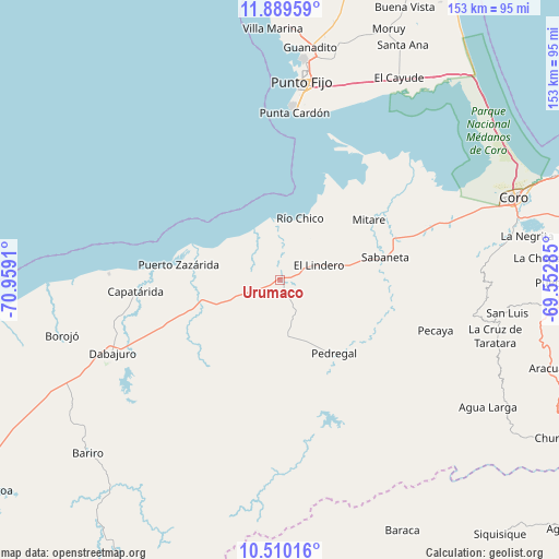
Urumaco GPS coordinates[2]
11° 12' 2.52" North, 70° 15' 21.492" West
| Map corner | latitude | longitude |
|---|---|---|
| Upper-left | 11.88959°, | -70.9591° |
| Center: | 11.2007°, | -70.25597° |
| Lower-right: | 10.51016°, | -69.55285° |
| Map W x H: | 153.4×153.4 km | = 95.3×95.3mi |
| max Lat: | 11.94788° ⇑2.3% North |
| Urumaco: | 11.2007° |
| min Lat: | ⇓97.7% South 1.92027° |
| min Long | Urumaco | max Long |
| -72.55212° | -70.25597° | -60.99778° |
| W 30.8%⇐ | ⇒69.2% E |
Elevation
Elevation of Urumaco is 92 m = 302 ft, and this is 288.6 m = 947 ft below average elevation for this country.
| Max E: |
2986 m = 9797 ft | 68.2% |
| Avg. | 380.6 m = 1249 ft | |
| Urumaco | 92 m = 302 ft | |
Min E: |
-4 m = -13 ft | 31.8% |
See also: Venezuela elevation on elevation.city.
Geographical zone
Urumaco is located in North Torrid zone (between Equator and Tropic of Cancer). Distance of Equator is 1245.4 km =773.9 mi to South.| Distance of | km | miles | from Urumaco |
|---|---|---|---|
| North Pole | 8761.7 | 5444.3 | to North |
| Arctic Circle | 6155.8 | 3825 | to North |
| Tropic Cancer | 1360.5 | 845.4 | to North |
| Equator | 1245.4 | 773.9 | to South |


Nearby cities:
15 places around Urumaco: (largest is in red/bold)
• Cabure
70.5 km =43.8 mi,  95°
95°
• Canape Capatárida
39.9 km =24.8 mi,  265°
265°
• Churuguara
89.5 km =55.6 mi,  118°
118°
• Coro
67.4 km =41.9 mi,  70°
70°
• Dabajuro
50.1 km =31.1 mi,  246°
246°
• La Cruz de Taratara
61.2 km =38 mi, 104°
• La Vela de Coro
80.6 km =50.1 mi, 68°
• Mene de Mauroa
102.9 km =63.9 mi,  235°
235°
• Pedregal
25 km =15.5 mi,  143°
143°
• Pueblo Nuevo
90.6 km =56.3 mi,  23°
23°
• Punta Cardón
51 km =31.7 mi,  5°
5°
• Punto Fijo
54.9 km =34.1 mi, 6°
• San Luis
63 km =39.1 mi, 98°
• Santa Cruz de los Taques
69.2 km =43 mi,  359°
359°
• Siquisique
92.5 km =57.5 mi, 139°
Sources, notices
• [Note1] Compared only with cities in Venezuela existing in our database
• [Src1] Map data: © OpenStreetMap contributors (CC-BY-SA)
• [Src2] Other city data from geonames.org with taken over terms of usage.
• [Src3] Geographical zone / Annual Mean Temperature by Robert A. Rohde @ Wikipedia
