Siquisique geodata
Siquisique (Lara) is a seat of a second-order administrative division; located in Venezuela in America/Caracas (GMT-4) time zone. In our database, there are 108 cities with bigger population. Compared to other cities in Venezuela, 85.5% of cities are located further ↓South; 61.6% of cities are located further →East and 62.1% of cities have lower elevation than Siquisique. Note1


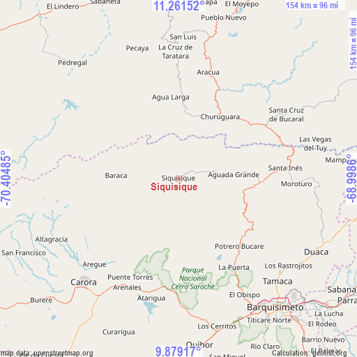
Siquisique GPS coordinates[2]
10° 34' 16.032" North, 69° 42' 6.192" West
| Map corner | latitude | longitude |
|---|---|---|
| Upper-left | 11.26152°, | -70.40485° |
| Center: | 10.57112°, | -69.70172° |
| Lower-right: | 9.87917°, | -68.9986° |
| Map W x H: | 153.7×153.7 km | = 95.5×95.5mi |
| max Lat: | 11.94788° ⇑14.5% North |
| Siquisique: | 10.57112° |
| min Lat: | ⇓85.5% South 1.92027° |
| min Long | Siquisique | max Long |
| -72.55212° | -69.70172° | -60.99778° |
| W 38.4%⇐ | ⇒61.6% E |
Elevation
Elevation of Siquisique is 281 m = 922 ft, and this is 99.6 m = 327 ft below average elevation for this country.
| Max E: |
2986 m = 9797 ft | 37.9% |
| Avg. | 380.6 m = 1249 ft | |
| Siquisique | 281 m = 922 ft | |
Min E: |
-4 m = -13 ft | 62.1% |
See also: Venezuela elevation on elevation.city.
Geographical zone
Siquisique is located in North Torrid zone (between Equator and Tropic of Cancer). Distance of Equator is 1175.4 km =730.4 mi to South.| Distance of | km | miles | from Siquisique |
|---|---|---|---|
| North Pole | 8831.7 | 5487.8 | to North |
| Arctic Circle | 6225.8 | 3868.5 | to North |
| Tropic Cancer | 1430.5 | 888.9 | to North |
| Equator | 1175.4 | 730.4 | to South |


Nearby cities:
15 places around Siquisique: (largest is in red/bold)
• Barquisimeto
67.8 km =42.1 mi,  146°
146°
• Cabudare
77.3 km =48 mi,  141°
141°
• Cabure
64.6 km =40.1 mi,  8°
8°
• Carora
60.7 km =37.7 mi,  223°
223°
• Churuguara
32.3 km =20.1 mi,  33°
33°
• Duaca
67 km =41.6 mi,  118°
118°
• El Tocuyo
87.7 km =54.5 mi,  186°
186°
• La Cruz de Taratara
54.7 km =34 mi,  358°
358°
• Los Rastrojos
78.8 km =49 mi, 140°
• Pedregal
67.7 km =42.1 mi,  317°
317°
• Quíbor
72 km =44.7 mi,  172°
172°
• Sabana de Parra
88.3 km =54.9 mi, 124°
• San Luis
61.1 km =38 mi,  1°
1°
• Santa Cruz de Bucaral
54 km =33.6 mi,  59°
59°
• Yaritagua
83.4 km =51.8 mi,  130°
130°
Sources, notices
• [Note1] Compared only with cities in Venezuela existing in our database
• [Src1] Map data: © OpenStreetMap contributors (CC-BY-SA)
• [Src2] Other city data from geonames.org with taken over terms of usage.
• [Src3] Geographical zone / Annual Mean Temperature by Robert A. Rohde @ Wikipedia
