Maiquetía geodata
Maiquetía (Vargas) is a seat of a third-order administrative division; located in Venezuela in America/Caracas (GMT-4) time zone. With population of 52,564 people, there are 72 cities with bigger population in this country. Compared to other cities in Venezuela, 86.8% of cities are located further ↓South; 69.7% of cities are located further ←West and 71.8% of cities have higher elevation than Maiquetía. Note1


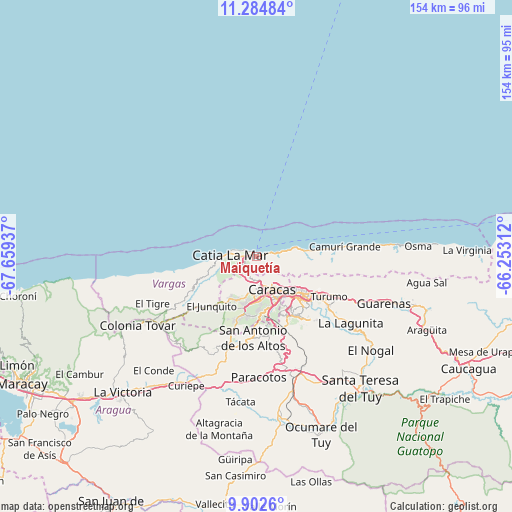
Maiquetía GPS coordinates[2]
10° 35' 40.2" North, 66° 57' 22.464" West
| Map corner | latitude | longitude |
|---|---|---|
| Upper-left | 11.28484°, | -67.65937° |
| Center: | 10.5945°, | -66.95624° |
| Lower-right: | 9.9026°, | -66.25312° |
| Map W x H: | 153.7×153.7 km | = 95.5×95.5mi |
| max Lat: | 11.94788° ⇑13.2% North |
| Maiquetía: | 10.5945° |
| min Lat: | ⇓86.8% South 1.92027° |
| min Long | Maiquetía | max Long |
| -72.55212° | -66.95624° | -60.99778° |
| W 69.7%⇐ | ⇒30.3% E |
Elevation
Elevation of Maiquetía is 83 m = 272 ft, and this is 297.6 m = 976 ft below average elevation for this country.
| Max E: |
2986 m = 9797 ft | 71.8% |
| Avg. | 380.6 m = 1249 ft | |
| Maiquetía | 83 m = 272 ft | |
Min E: |
-4 m = -13 ft | 28.2% |
See also: Maiquetía elevation on elevation.city.
Geographical zone
Maiquetía is located in North Torrid zone (between Equator and Tropic of Cancer). Distance of Equator is 1178 km =732 mi to South.| Distance of | km | miles | from Maiquetía |
|---|---|---|---|
| North Pole | 8829.1 | 5486.1 | to North |
| Arctic Circle | 6223.2 | 3866.9 | to North |
| Tropic Cancer | 1427.9 | 887.3 | to North |
| Equator | 1178 | 732 | to South |


Nearby cities:
15 places around Maiquetía: (largest is in red/bold)
• Baruta
19.9 km =12.4 mi,  153°
153°
• Caraballeda
11.6 km =7.2 mi,  80°
80°
• Caracas
14.5 km =9 mi,  144°
144°
• Caricuao
18.2 km =11.3 mi,  189°
189°
• Catia La Mar
8.4 km =5.2 mi,  278°
278°
• Chacao
15.7 km =9.8 mi,  134°
134°
• El Cafetal
19.9 km =12.4 mi, 136°
• El Hatillo
23.7 km =14.7 mi, 143°
• El Junko
19.4 km =12.1 mi,  225°
225°
• La Dolorita
22 km =13.7 mi,  122°
122°
• La Guaira
2.7 km =1.7 mi,  72°
72°
• Los Dos Caminos
17.9 km =11.1 mi, 128°
• Macuto
6.5 km =4 mi, 79°
• Petare
20.8 km =12.9 mi, 128°
• San Antonio de Los Altos
22.9 km =14.2 mi,  178°
178°
Sources, notices
• [Note1] Compared only with cities in Venezuela existing in our database
• [Src1] Map data: © OpenStreetMap contributors (CC-BY-SA)
• [Src2] Other city data from geonames.org with taken over terms of usage.
• [Src3] Geographical zone / Annual Mean Temperature by Robert A. Rohde @ Wikipedia
