Las Vegas geodata
Las Vegas (Cojedes) is a seat of a second-order administrative division; located in Venezuela in America/Caracas (GMT-4) time zone. In our database, there are 108 cities with bigger population. Compared to other cities in Venezuela, 51.1% of cities are located further ↑North; 52.2% of cities are located further ←West and 62.1% of cities have higher elevation than Las Vegas. Note1


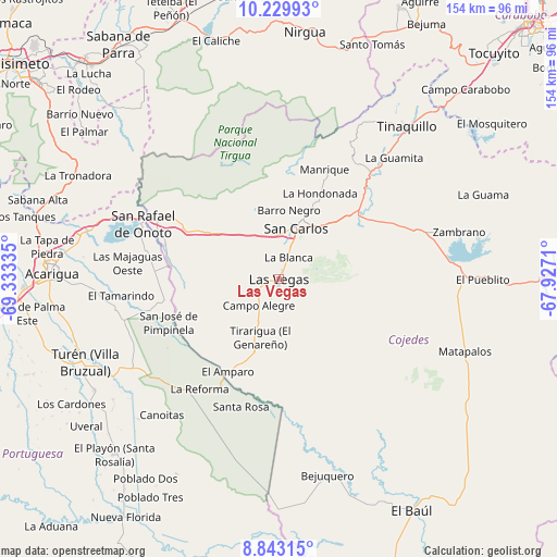
Las Vegas GPS coordinates[2]
9° 32' 14.064" North, 68° 37' 48.792" West
| Map corner | latitude | longitude |
|---|---|---|
| Upper-left | 10.22993°, | -69.33335° |
| Center: | 9.53724°, | -68.63022° |
| Lower-right: | 8.84315°, | -67.9271° |
| Map W x H: | 154.2×154.2 km | = 95.8×95.8mi |
| max Lat: | 11.94788° ⇑51.1% North |
| Las Vegas: | 9.53724° |
| min Lat: | ⇓48.9% South 1.92027° |
| min Long | Las Vegas | max Long |
| -72.55212° | -68.63022° | -60.99778° |
| W 52.2%⇐ | ⇒47.8% E |
Elevation
Elevation of Las Vegas is 120 m = 394 ft, and this is 260.6 m = 855 ft below average elevation for this country.
| Max E: |
2986 m = 9797 ft | 62.1% |
| Avg. | 380.6 m = 1249 ft | |
| Las Vegas | 120 m = 394 ft | |
Min E: |
-4 m = -13 ft | 37.9% |
See also: Venezuela elevation on elevation.city.
Geographical zone
Las Vegas is located in North Torrid zone (between Equator and Tropic of Cancer). Distance of Equator is 1060.4 km =658.9 mi to South.| Distance of | km | miles | from Las Vegas |
|---|---|---|---|
| North Pole | 8946.6 | 5559.2 | to North |
| Arctic Circle | 6340.7 | 3939.9 | to North |
| Tropic Cancer | 1545.5 | 960.3 | to North |
| Equator | 1060.4 | 658.9 | to South |


Nearby cities:
15 places around Las Vegas: (largest is in red/bold)
• Acarigua
62 km =38.5 mi,  271°
271°
• Agua Blanca
54.1 km =33.6 mi,  284°
284°
• Araure
66.9 km =41.6 mi, 274°
• Cojedes
32.9 km =20.4 mi,  286°
286°
• El Pao
56.1 km =34.9 mi,  78°
78°
• El Playón
66.6 km =41.4 mi,  223°
223°
• Libertad
21.2 km =13.2 mi,  198°
198°
• Macapo
38.3 km =23.8 mi,  33°
33°
• Píritu
66.3 km =41.2 mi,  253°
253°
• San Carlos
14.7 km =9.1 mi,  20°
20°
• San Rafael de Onoto
40.7 km =25.3 mi, 292°
• Sarare
64.4 km =40 mi, 294°
• Tinaco
28.1 km =17.5 mi,  50°
50°
• Tinaquillo
55.4 km =34.4 mi,  40°
40°
• Villa Bruzual
58.3 km =36.2 mi, 246°
Sources, notices
• [Note1] Compared only with cities in Venezuela existing in our database
• [Src1] Map data: © OpenStreetMap contributors (CC-BY-SA)
• [Src2] Other city data from geonames.org with taken over terms of usage.
• [Src3] Geographical zone / Annual Mean Temperature by Robert A. Rohde @ Wikipedia
