San Carlos geodata
San Carlos (Cojedes) is a seat of a first-order administrative division; located in Venezuela in America/Caracas (GMT-4) time zone. With population of 77,192 people, there are 53 cities with bigger population in this country. Compared to other cities in Venezuela, 51.7% of cities are located further ↓South; 52.4% of cities are located further ←West and 56% of cities have higher elevation than San Carlos. Note1


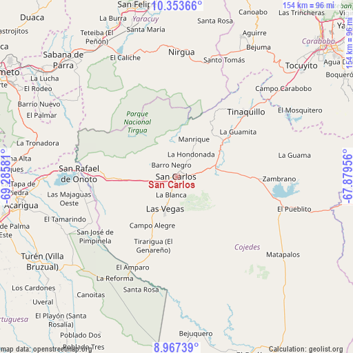
San Carlos GPS coordinates[2]
9° 39' 40.464" North, 68° 34' 57.648" West
| Map corner | latitude | longitude |
|---|---|---|
| Upper-left | 10.35366°, | -69.28581° |
| Center: | 9.66124°, | -68.58268° |
| Lower-right: | 8.96739°, | -67.87956° |
| Map W x H: | 154.1×154.1 km | = 95.8×95.8mi |
| max Lat: | 11.94788° ⇑48.3% North |
| San Carlos: | 9.66124° |
| min Lat: | ⇓51.7% South 1.92027° |
| min Long | San Carlos | max Long |
| -72.55212° | -68.58268° | -60.99778° |
| W 52.4%⇐ | ⇒47.6% E |
Elevation
Elevation of San Carlos is 156 m = 512 ft, and this is 224.6 m = 737 ft below average elevation for this country.
| Max E: |
2986 m = 9797 ft | 56% |
| Avg. | 380.6 m = 1249 ft | |
| San Carlos | 156 m = 512 ft | |
Min E: |
-4 m = -13 ft | 44% |
See also: San Carlos elevation on elevation.city.
Geographical zone
San Carlos is located in North Torrid zone (between Equator and Tropic of Cancer). Distance of Equator is 1074.2 km =667.5 mi to South.| Distance of | km | miles | from San Carlos |
|---|---|---|---|
| North Pole | 8932.8 | 5550.6 | to North |
| Arctic Circle | 6326.9 | 3931.4 | to North |
| Tropic Cancer | 1531.7 | 951.8 | to North |
| Equator | 1074.2 | 667.5 | to South |


Nearby cities:
15 places around San Carlos: (largest is in red/bold)
• Agua Blanca
57.4 km =35.7 mi,  270°
270°
• Bejuma
67.1 km =41.7 mi,  31°
31°
• Chivacoa
65.1 km =40.5 mi,  328°
328°
• Cojedes
37 km =23 mi,  263°
263°
• El Pao
49.8 km =30.9 mi,  92°
92°
• Las Vegas
14.7 km =9.1 mi,  200°
200°
• Libertad
35.9 km =22.3 mi, 199°
• Macapo
24.1 km =15 mi,  40°
40°
• Miranda
58.3 km =36.2 mi,  20°
20°
• Montalbán
67.5 km =41.9 mi, 24°
• Nirgua
54.4 km =33.8 mi,  2°
2°
• San Rafael de Onoto
42.8 km =26.6 mi, 272°
• Sarare
65 km =40.4 mi,  281°
281°
• Tinaco
17 km =10.6 mi,  75°
75°
• Tinaquillo
41.8 km =26 mi,  46°
46°
Sources, notices
• [Note1] Compared only with cities in Venezuela existing in our database
• [Src1] Map data: © OpenStreetMap contributors (CC-BY-SA)
• [Src2] Other city data from geonames.org with taken over terms of usage.
• [Src3] Geographical zone / Annual Mean Temperature by Robert A. Rohde @ Wikipedia
