Caucaguita geodata
Caucaguita (Miranda) is a populated place; located in Venezuela in America/Caracas (GMT-4) time zone. With population of 59,000 people, there are 64 cities with bigger population in this country. Compared to other cities in Venezuela, 76.8% of cities are located further ↓South; 73.5% of cities are located further ←West and 88.8% of cities have lower elevation than Caucaguita. Note1


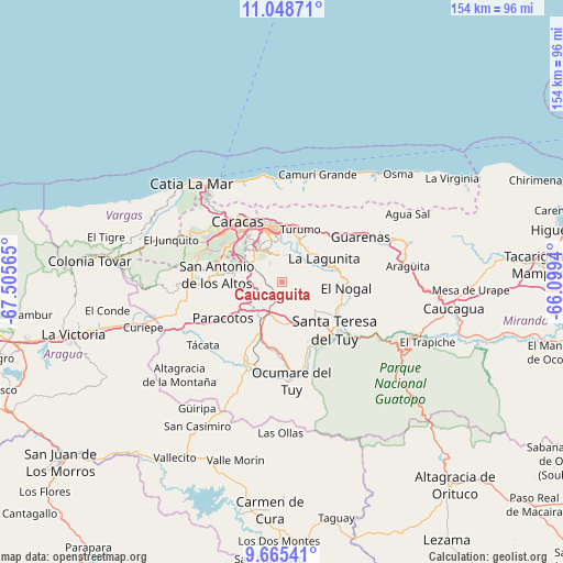
Caucaguita GPS coordinates[2]
10° 21' 28.152" North, 66° 48' 9.072" West
| Map corner | latitude | longitude |
|---|---|---|
| Upper-left | 11.04871°, | -67.50565° |
| Center: | 10.35782°, | -66.80252° |
| Lower-right: | 9.66541°, | -66.0994° |
| Map W x H: | 153.8×153.8 km | = 95.6×95.6mi |
| max Lat: | 11.94788° ⇑23.2% North |
| Caucaguita: | 10.35782° |
| min Lat: | ⇓76.8% South 1.92027° |
| min Long | Caucaguita | max Long |
| -72.55212° | -66.80252° | -60.99778° |
| W 73.5%⇐ | ⇒26.5% E |
Elevation
Elevation of Caucaguita is 1003 m = 3291 ft, and this is 622.4 m = 2042 ft above average elevation for this country.
| Max E: |
2986 m = 9797 ft | 11.2% |
| Caucaguita | 1003 m 3291 ft | |
| Avg. | 380.6 m = 1249 ft | |
Min E: |
-4 m = -13 ft | 88.8% |
See also: Caucaguita elevation on elevation.city.
Geographical zone
Caucaguita is located in North Torrid zone (between Equator and Tropic of Cancer). Distance of Equator is 1151.7 km =715.6 mi to South.| Distance of | km | miles | from Caucaguita |
|---|---|---|---|
| North Pole | 8855.4 | 5502.5 | to North |
| Arctic Circle | 6249.5 | 3883.3 | to North |
| Tropic Cancer | 1454.2 | 903.6 | to North |
| Equator | 1151.7 | 715.6 | to South |


Nearby cities:
15 places around Caucaguita: (largest is in red/bold)
• Baruta
11.7 km =7.3 mi,  316°
316°
• Caracas
16.7 km =10.4 mi,  329°
329°
• Carrizal
20.1 km =12.5 mi,  267°
267°
• Caucagüito
16 km =9.9 mi,  26°
26°
• Chacao
16.3 km =10.1 mi,  339°
339°
• Charallave
14.2 km =8.8 mi,  205°
205°
• El Cafetal
12.3 km =7.6 mi,  346°
346°
• El Hatillo
7.8 km =4.8 mi, 340°
• La Dolorita
14.6 km =9.1 mi,  7°
7°
• Los Dos Caminos
15.4 km =9.6 mi, 349°
• Petare
13.2 km =8.2 mi,  357°
357°
• San Antonio de Los Altos
16.7 km =10.4 mi,  281°
281°
• San Francisco de Yare
20.9 km =13 mi,  162°
162°
• Santa Lucía
16.7 km =10.4 mi,  110°
110°
• Santa Teresa del Tuy
20.5 km =12.7 mi,  132°
132°
Sources, notices
• [Note1] Compared only with cities in Venezuela existing in our database
• [Src1] Map data: © OpenStreetMap contributors (CC-BY-SA)
• [Src2] Other city data from geonames.org with taken over terms of usage.
• [Src3] Geographical zone / Annual Mean Temperature by Robert A. Rohde @ Wikipedia
