Caucagüito geodata
Caucagüito (Miranda) is a populated place; located in Venezuela in America/Caracas (GMT-4) time zone. With population of 52,556 people, there are 73 cities with bigger population in this country. Compared to other cities in Venezuela, 82.2% of cities are located further ↓South; 74.8% of cities are located further ←West and 81.4% of cities have lower elevation than Caucagüito. Note1


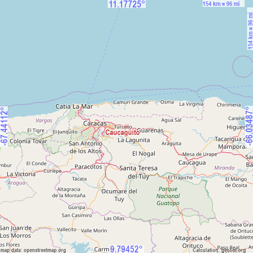
Caucagüito GPS coordinates[2]
10° 29' 11.976" North, 66° 44' 16.764" West
| Map corner | latitude | longitude |
|---|---|---|
| Upper-left | 11.17725°, | -67.44112° |
| Center: | 10.48666°, | -66.73799° |
| Lower-right: | 9.79452°, | -66.03487° |
| Map W x H: | 153.7×153.7 km | = 95.5×95.5mi |
| max Lat: | 11.94788° ⇑17.8% North |
| Caucagüito: | 10.48666° |
| min Lat: | ⇓82.2% South 1.92027° |
| min Long | Caucagüito | max Long |
| -72.55212° | -66.73799° | -60.99778° |
| W 74.8%⇐ | ⇒25.2% E |
Elevation
Elevation of Caucagüito is 707 m = 2320 ft, and this is 326.4 m = 1071 ft above average elevation for this country.
| Max E: |
2986 m = 9797 ft | 18.6% |
| Caucagüito | 707 m 2320 ft | |
| Avg. | 380.6 m = 1249 ft | |
Min E: |
-4 m = -13 ft | 81.4% |
See also: Caucagüito elevation on elevation.city.
Geographical zone
Caucagüito is located in North Torrid zone (between Equator and Tropic of Cancer). Distance of Equator is 1166 km =724.5 mi to South.| Distance of | km | miles | from Caucagüito |
|---|---|---|---|
| North Pole | 8841.1 | 5493.6 | to North |
| Arctic Circle | 6235.2 | 3874.4 | to North |
| Tropic Cancer | 1439.9 | 894.7 | to North |
| Equator | 1166 | 724.5 | to South |


Nearby cities:
15 places around Caucagüito: (largest is in red/bold)
• Baruta
16.1 km =10 mi,  248°
248°
• Caraballeda
18.7 km =11.6 mi,  318°
318°
• Caracas
15.4 km =9.6 mi,  270°
270°
• Caucaguita
16 km =9.9 mi,  206°
206°
• Chacao
12.7 km =7.9 mi, 274°
• El Cafetal
10.3 km =6.4 mi,  256°
256°
• El Hatillo
11.9 km =7.4 mi,  234°
234°
• Guarenas
13.1 km =8.1 mi,  97°
97°
• Guatire
21.4 km =13.3 mi,  93°
93°
• La Dolorita
5.3 km =3.3 mi, 271°
• Los Dos Caminos
9.9 km =6.2 mi, 274°
• Macuto
21.8 km =13.5 mi,  307°
307°
• Naiguatá
14.9 km =9.3 mi,  359°
359°
• Petare
7.7 km =4.8 mi, 261°
• Santa Lucía
21.9 km =13.6 mi,  157°
157°
Sources, notices
• [Note1] Compared only with cities in Venezuela existing in our database
• [Src1] Map data: © OpenStreetMap contributors (CC-BY-SA)
• [Src2] Other city data from geonames.org with taken over terms of usage.
• [Src3] Geographical zone / Annual Mean Temperature by Robert A. Rohde @ Wikipedia
