Santa Teresa del Tuy geodata
Santa Teresa del Tuy (Miranda) is a seat of a second-order administrative division; located in Venezuela in America/Caracas (GMT-4) time zone. With population of 278,890 people, there are 15 cities with bigger population in this country. Compared to other cities in Venezuela, 69.7% of cities are located further ↓South; 75.3% of cities are located further ←West and 60.1% of cities have higher elevation than Santa Teresa del Tuy. Note1


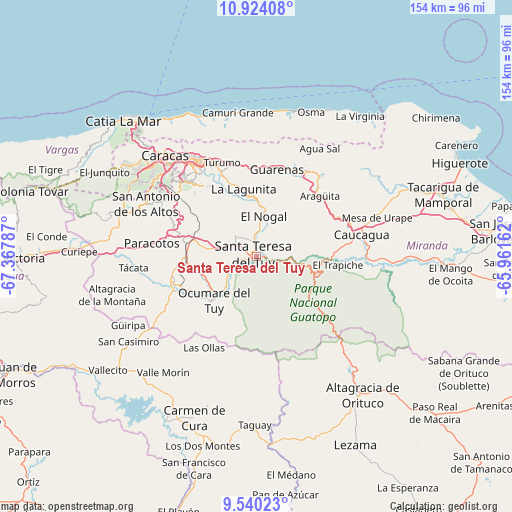
Santa Teresa del Tuy GPS coordinates[2]
10° 13' 58.476" North, 66° 39' 53.064" West
| Map corner | latitude | longitude |
|---|---|---|
| Upper-left | 10.92408°, | -67.36787° |
| Center: | 10.23291°, | -66.66474° |
| Lower-right: | 9.54023°, | -65.96162° |
| Map W x H: | 153.9×153.9 km | = 95.6×95.6mi |
| max Lat: | 11.94788° ⇑30.3% North |
| Santa Teresa del Tuy: | 10.23291° |
| min Lat: | ⇓69.7% South 1.92027° |
| min Long | Santa Teresa de | max Long |
| -72.55212° | -66.66474° | -60.99778° |
| W 75.3%⇐ | ⇒24.7% E |
Elevation
Elevation of Santa Teresa del Tuy is 135 m = 443 ft, and this is 245.6 m = 806 ft below average elevation for this country.
| Max E: |
2986 m = 9797 ft | 60.1% |
| Avg. | 380.6 m = 1249 ft | |
| Santa Teresa del Tuy | 135 m = 443 ft | |
Min E: |
-4 m = -13 ft | 39.9% |
See also: Santa Teresa del Tuy elevation on elevation.city.
Geographical zone
Santa Teresa del Tuy is located in North Torrid zone (between Equator and Tropic of Cancer). Distance of Equator is 1137.8 km =707 mi to South.| Distance of | km | miles | from Santa Teresa del Tuy |
|---|---|---|---|
| North Pole | 8869.3 | 5511.1 | to North |
| Arctic Circle | 6263.4 | 3891.9 | to North |
| Tropic Cancer | 1468.1 | 912.2 | to North |
| Equator | 1137.8 | 707 | to South |


Nearby cities:
15 places around Santa Teresa del Tuy: (largest is in red/bold)
• Baruta
32.1 km =19.9 mi,  314°
314°
• Caucagua
32.1 km =19.9 mi,  79°
79°
• Caucaguita
20.5 km =12.7 mi, 312°
• Caucagüito
29.3 km =18.2 mi,  344°
344°
• Charallave
21.1 km =13.1 mi,  272°
272°
• Cúa
25.1 km =15.6 mi,  251°
251°
• El Cafetal
31.5 km =19.6 mi,  325°
325°
• El Hatillo
27.6 km =17.1 mi,  320°
320°
• Guarenas
26.9 km =16.7 mi,  10°
10°
• Guatire
30 km =18.6 mi,  26°
26°
• La Dolorita
31.3 km =19.4 mi, 334°
• Ocumare del Tuy
17.6 km =10.9 mi,  223°
223°
• Petare
31.3 km =19.4 mi, 330°
• San Francisco de Yare
10.8 km =6.7 mi,  235°
235°
• Santa Lucía
8 km =5 mi,  3°
3°
Sources, notices
• [Note1] Compared only with cities in Venezuela existing in our database
• [Src1] Map data: © OpenStreetMap contributors (CC-BY-SA)
• [Src2] Other city data from geonames.org with taken over terms of usage.
• [Src3] Geographical zone / Annual Mean Temperature by Robert A. Rohde @ Wikipedia
