Móng Cái geodata
Móng Cái (Quảng Ninh) is a seat of a second-order administrative division; located in Vietnam in Asia/Ho_Chi_Minh (GMT+7) time zone. With population of 72,960 people, there are 43 cities with bigger population in this country. Compared to other cities in Vietnam, 86.5% of cities are located further ↓South; 84.2% of cities are located further ←West and 65.4% of cities have higher elevation than Móng Cái. Note1


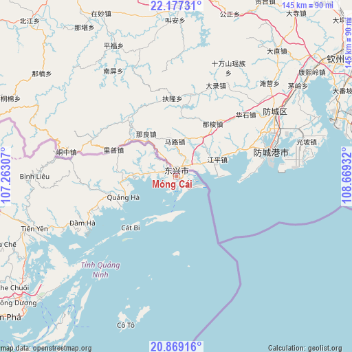
Móng Cái GPS coordinates[2]
21° 31' 28.956" North, 107° 57' 58.284" East
| Map corner | latitude | longitude |
|---|---|---|
| Upper-left | 22.17731°, | 107.26307° |
| Center: | 21.52471°, | 107.96619° |
| Lower-right: | 20.86916°, | 108.66932° |
| Map W x H: | 145.5×145.5 km | = 90.4×90.4mi |
| max Lat: | 23.27841° ⇑13.5% North |
| Móng Cái: | 21.52471° |
| min Lat: | ⇓86.5% South 8.65724° |
| min Long | Móng Cái | max Long |
| 102.4579° | 107.96619° | 112.72541° |
| W 84.2%⇐ | ⇒15.8% E |
Elevation
Elevation of Móng Cái is 9 m = 30 ft, and this is 120.5 m = 395 ft below average elevation for this country.
| Max E: |
1592 m = 5223 ft | 65.4% |
| Avg. | 129.5 m = 425 ft | |
| Móng Cái | 9 m = 30 ft | |
Min E: |
-1 m = -3 ft | 34.6% |
See also: Móng Cái elevation on elevation.city.
Geographical zone
Móng Cái is located in North Torrid zone (between Equator and Tropic of Cancer). Distance of this Northern Tropic circle is 212.6 km =132.1 mi to North.| Distance of | km | miles | from Móng Cái |
|---|---|---|---|
| North Pole | 7613.7 | 4730.9 | to North |
| Arctic Circle | 5007.9 | 3111.8 | to North |
| Tropic Cancer | 212.6 | 132.1 | to North |
| Equator | 2393.3 | 1487.1 | to South |


Nearby cities:
15 places around Móng Cái: (largest is in red/bold)
• An Châu
117.5 km =73 mi,  259°
259°
• Cát Bà
130.1 km =80.8 mi,  227°
227°
• Cô Tô
64.8 km =40.3 mi,  198°
198°
• Cẩm Phả
91.8 km =57 mi, 231°
• Cẩm Phả Mines
89.2 km =55.4 mi, 230°
• Hạ Long
112.4 km =69.8 mi,  235°
235°
• Lạng Sơn
129.7 km =80.6 mi,  286°
286°
• Lộc Bình
110.9 km =68.9 mi,  283°
283°
• Quảng Hà
23.3 km =14.5 mi,  249°
249°
• Quảng Yên
136.9 km =85.1 mi, 241°
• Thành Phố Uông Bí
135.4 km =84.1 mi, 246°
• Thị Trấn Cao Lộc
129.5 km =80.5 mi, 287°
• Trới
115 km =71.5 mi, 241°
• Đình Lập
89.8 km =55.8 mi,  271°
271°
• Đồng Mỏ
144.2 km =89.6 mi, 275°
Sources, notices
• [Note1] Compared only with cities in Vietnam existing in our database
• [Src1] Map data: © OpenStreetMap contributors (CC-BY-SA)
• [Src2] Other city data from geonames.org with taken over terms of usage.
• [Src3] Geographical zone / Annual Mean Temperature by Robert A. Rohde @ Wikipedia
