Ad Dīs ash Sharqīyah geodata
Ad Dīs ash Sharqīyah (Ḩaḑramawt) is a seat of a second-order administrative division; located in Yemen in Asia/Aden (GMT+3) time zone. In our database, there are 51 cities with bigger population. Compared to other cities in Yemen, 51% of cities are located further ↓South; 95.5% of cities are located further ←West and 89% of cities have higher elevation than Ad Dīs ash Sharqīyah. Note1
Current local time in Ad Dīs ash Sharqīyah:
01:51 AM, WednesdayDifference from your time zone: hours


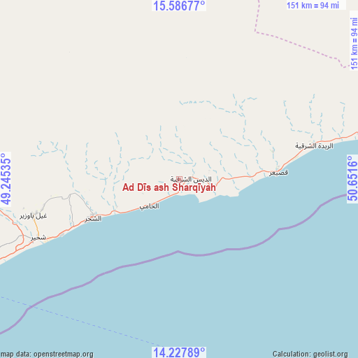
Ad Dīs ash Sharqīyah GPS coordinates[2]
14° 54' 30.24" North, 49° 56' 54.492" East
| Map corner | latitude | longitude |
|---|---|---|
| Upper-left | 15.58677°, | 49.24535° |
| Center: | 14.9084°, | 49.94847° |
| Lower-right: | 14.22789°, | 50.6516° |
| Map W x H: | 151.1×151.1 km | = 93.9×93.9mi |
| max Lat: | 17.76999° ⇑49% North |
| Ad Dīs ash Sharqīyah: | 14.9084° |
| min Lat: | ⇓51% South 12.18576° |
| min Long | Ad Dīs ash Sha | max Long |
| 42.67107° | 49.94847° | 54.01895° |
| W 95.5%⇐ | ⇒4.5% E |
Elevation
Elevation of Ad Dīs ash Sharqīyah is 75 m = 246 ft, and this is 1229.8 m = 4035 ft below average elevation for this country.
| Max E: |
2791 m = 9157 ft | 89% |
| Avg. | 1304.8 m = 4281 ft | |
| Ad Dīs ash Sharqīyah | 75 m = 246 ft | |
Min E: |
4 m = 13 ft | 11% |
See also: Yemen elevation on elevation.city.
Geographical zone
Ad Dīs ash Sharqīyah is located in North Torrid zone (between Equator and Tropic of Cancer). Distance of this Northern Tropic circle is 948.3 km =589.2 mi to North.| Distance of | km | miles | from Ad Dīs ash Sharqīyah |
|---|---|---|---|
| North Pole | 8349.4 | 5188.1 | to North |
| Arctic Circle | 5743.5 | 3568.8 | to North |
| Tropic Cancer | 948.3 | 589.2 | to North |
| Equator | 1657.7 | 1030 | to South |


Nearby cities:
15 places around Ad Dīs ash Sharqīyah: (largest is in red/bold)
• Al Bilād
153.8 km =95.6 mi,  332°
332°
• Al ‘Ulayb
97.7 km =60.7 mi,  285°
285°
• Al ‘Ummāl
168.6 km =104.8 mi,  313°
313°
• Ar Raydah
58.7 km =36.5 mi,  76°
76°
• Ash Shiḩr
40.4 km =25.1 mi,  245°
245°
• At Taḩāluf
169.2 km =105.1 mi, 312°
• Ath Thawrah
169.3 km =105.2 mi, 312°
• Burūm
120.5 km =74.9 mi,  239°
239°
• Bāḩashawān
169.6 km =105.4 mi, 312°
• Daḩasuways
123.4 km =76.7 mi,  42°
42°
• Ghayl Bā Wazīr
64.3 km =40 mi,  256°
256°
• Mukalla
97.5 km =60.6 mi, 245°
• Sayḩūt
143.3 km =89 mi, 76°
• Sāh
139.3 km =86.6 mi,  302°
302°
• Tarīm
163.3 km =101.5 mi,  321°
321°
Sources, notices
• [Note1] Compared only with cities in Yemen existing in our database
• [Src1] Map data: © OpenStreetMap contributors (CC-BY-SA)
• [Src2] Other city data from geonames.org with taken over terms of usage.
• [Src3] Geographical zone / Annual Mean Temperature by Robert A. Rohde @ Wikipedia
