Ash Shiḩr geodata
Ash Shiḩr (Ḩaḑramawt) is a seat of a second-order administrative division; located in Yemen in Asia/Aden (GMT+3) time zone. In our database, there are 51 cities with bigger population. Compared to other cities in Yemen, 52.9% of cities are located further ↑North; 94.8% of cities are located further ←West and 93.8% of cities have higher elevation than Ash Shiḩr. Note1


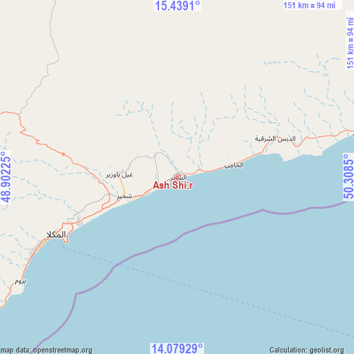
Ash Shiḩr GPS coordinates[2]
14° 45' 36.936" North, 49° 36' 19.332" East
| Map corner | latitude | longitude |
|---|---|---|
| Upper-left | 15.4391°, | 48.90225° |
| Center: | 14.76026°, | 49.60537° |
| Lower-right: | 14.07929°, | 50.3085° |
| Map W x H: | 151.2×151.2 km | = 94×94mi |
| max Lat: | 17.76999° ⇑52.9% North |
| Ash Shiḩr: | 14.76026° |
| min Lat: | ⇓47.1% South 12.18576° |
| min Long | Ash Shiḩr | max Long |
| 42.67107° | 49.60537° | 54.01895° |
| W 94.8%⇐ | ⇒5.2% E |
Elevation
Elevation of Ash Shiḩr is 17 m = 56 ft, and this is 1287.8 m = 4225 ft below average elevation for this country.
| Max E: |
2791 m = 9157 ft | 93.8% |
| Avg. | 1304.8 m = 4281 ft | |
| Ash Shiḩr | 17 m = 56 ft | |
Min E: |
4 m = 13 ft | 6.2% |
See also: Yemen elevation on elevation.city.
Geographical zone
Ash Shiḩr is located in North Torrid zone (between Equator and Tropic of Cancer). Distance of this Northern Tropic circle is 964.7 km =599.4 mi to North.| Distance of | km | miles | from Ash Shiḩr |
|---|---|---|---|
| North Pole | 8365.9 | 5198.3 | to North |
| Arctic Circle | 5760 | 3579.1 | to North |
| Tropic Cancer | 964.7 | 599.4 | to North |
| Equator | 1641.2 | 1019.8 | to South |


Nearby cities:
15 places around Ash Shiḩr: (largest is in red/bold)
• Ad Dīs ash Sharqīyah
40.4 km =25.1 mi,  65°
65°
• Al Bilād
156.8 km =97.4 mi,  347°
347°
• Al Bāţinah
149.3 km =92.8 mi,  302°
302°
• Al Jawl
146.5 km =91 mi,  256°
256°
• Al ‘Ulayb
71.6 km =44.5 mi,  306°
306°
• Al ‘Ummāl
157.5 km =97.9 mi,  326°
326°
• Ar Raydah
98.7 km =61.3 mi, 71°
• At Taḩāluf
157.7 km =98 mi, 326°
• Ath Thawrah
158 km =98.2 mi, 326°
• Burūm
80.5 km =50 mi,  236°
236°
• Bāḩashawān
158.2 km =98.3 mi, 326°
• Ghayl Bā Wazīr
25.8 km =16 mi,  273°
273°
• Mukalla
57.1 km =35.5 mi, 244°
• Sāh
121.7 km =75.6 mi,  318°
318°
• Şīf
150.1 km =93.3 mi,  294°
294°
Sources, notices
• [Note1] Compared only with cities in Yemen existing in our database
• [Src1] Map data: © OpenStreetMap contributors (CC-BY-SA)
• [Src2] Other city data from geonames.org with taken over terms of usage.
• [Src3] Geographical zone / Annual Mean Temperature by Robert A. Rohde @ Wikipedia
