Ar Raydah geodata
Ar Raydah (Ḩaḑramawt) is a seat of a second-order administrative division; located in Yemen in Asia/Aden (GMT+3) time zone. In our database, there are 51 cities with bigger population. Compared to other cities in Yemen, 52.9% of cities are located further ↓South; 95.8% of cities are located further ←West and 97.7% of cities have higher elevation than Ar Raydah. Note1


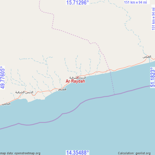
Ar Raydah GPS coordinates[2]
15° 2' 6" North, 50° 28' 45.012" East
| Map corner | latitude | longitude |
|---|---|---|
| Upper-left | 15.71296°, | 49.77605° |
| Center: | 15.035°, | 50.47917° |
| Lower-right: | 14.35488°, | 51.1823° |
| Map W x H: | 151×151 km | = 93.8×93.8mi |
| max Lat: | 17.76999° ⇑47.1% North |
| Ar Raydah: | 15.035° |
| min Lat: | ⇓52.9% South 12.18576° |
| min Long | Ar Raydah | max Long |
| 42.67107° | 50.47917° | 54.01895° |
| W 95.8%⇐ | ⇒4.2% E |
Elevation
Elevation of Ar Raydah is 10 m = 33 ft, and this is 1294.8 m = 4248 ft below average elevation for this country.
| Max E: |
2791 m = 9157 ft | 97.7% |
| Avg. | 1304.8 m = 4281 ft | |
| Ar Raydah | 10 m = 33 ft | |
Min E: |
4 m = 13 ft | 2.3% |
See also: Yemen elevation on elevation.city.
Geographical zone
Ar Raydah is located in North Torrid zone (between Equator and Tropic of Cancer). Distance of this Northern Tropic circle is 934.2 km =580.5 mi to North.| Distance of | km | miles | from Ar Raydah |
|---|---|---|---|
| North Pole | 8335.3 | 5179.3 | to North |
| Arctic Circle | 5729.4 | 3560.1 | to North |
| Tropic Cancer | 934.2 | 580.5 | to North |
| Equator | 1671.7 | 1038.7 | to South |


Nearby cities:
15 places around Ar Raydah: (largest is in red/bold)
• Ad Dīs ash Sharqīyah
58.7 km =36.5 mi,  256°
256°
• Al Bilād
176.7 km =109.8 mi,  313°
313°
• Al ‘Ulayb
151.4 km =94.1 mi,  274°
274°
• Al ‘Ummāl
206.3 km =128.2 mi,  299°
299°
• Ash Shiḩr
98.7 km =61.3 mi,  251°
251°
• Ath Thawrah
207.2 km =128.7 mi, 299°
• Burūm
177.7 km =110.4 mi, 245°
• Daḩasuways
81.2 km =50.5 mi,  19°
19°
• Ghayl Bā Wazīr
123 km =76.4 mi, 256°
• Mukalla
155.6 km =96.7 mi, 249°
• Qishn
135.7 km =84.3 mi,  71°
71°
• Sayḩūt
84.5 km =52.5 mi,  76°
76°
• Sāh
184.8 km =114.8 mi,  289°
289°
• Tarīm
195.1 km =121.2 mi, 305°
• Ḩaşwayn
184.5 km =114.6 mi, 70°
Sources, notices
• [Note1] Compared only with cities in Yemen existing in our database
• [Src1] Map data: © OpenStreetMap contributors (CC-BY-SA)
• [Src2] Other city data from geonames.org with taken over terms of usage.
• [Src3] Geographical zone / Annual Mean Temperature by Robert A. Rohde @ Wikipedia
