Sayḩūt geodata
Sayḩūt (Al Mahrah) is a seat of a second-order administrative division; located in Yemen in Asia/Aden (GMT+3) time zone. In our database, there are 51 cities with bigger population. Compared to other cities in Yemen, 56.5% of cities are located further ↓South; 96.8% of cities are located further ←West and 98.7% of cities have higher elevation than Sayḩūt. Note1


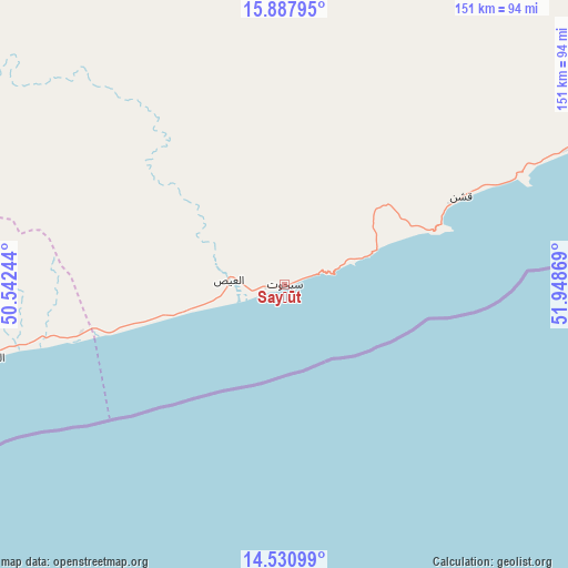
Sayḩūt GPS coordinates[2]
15° 12' 38.016" North, 51° 14' 44.016" East
| Map corner | latitude | longitude |
|---|---|---|
| Upper-left | 15.88795°, | 50.54244° |
| Center: | 15.21056°, | 51.24556° |
| Lower-right: | 14.53099°, | 51.94869° |
| Map W x H: | 150.9×150.9 km | = 93.8×93.8mi |
| max Lat: | 17.76999° ⇑43.5% North |
| Sayḩūt: | 15.21056° |
| min Lat: | ⇓56.5% South 12.18576° |
| min Long | Sayḩūt | max Long |
| 42.67107° | 51.24556° | 54.01895° |
| W 96.8%⇐ | ⇒3.2% E |
Elevation
Elevation of Sayḩūt is 8 m = 26 ft, and this is 1296.8 m = 4255 ft below average elevation for this country.
| Max E: |
2791 m = 9157 ft | 98.7% |
| Avg. | 1304.8 m = 4281 ft | |
| Sayḩūt | 8 m = 26 ft | |
Min E: |
4 m = 13 ft | 1.3% |
See also: Yemen elevation on elevation.city.
Geographical zone
Sayḩūt is located in North Torrid zone (between Equator and Tropic of Cancer). Distance of this Northern Tropic circle is 914.7 km =568.4 mi to North.| Distance of | km | miles | from Sayḩūt |
|---|---|---|---|
| North Pole | 8315.8 | 5167.2 | to North |
| Arctic Circle | 5709.9 | 3548 | to North |
| Tropic Cancer | 914.7 | 568.4 | to North |
| Equator | 1691.3 | 1050.9 | to South |


Nearby cities:
15 places around Sayḩūt: (largest is in red/bold)
• Ad Dīs ash Sharqīyah
143.3 km =89 mi,  256°
256°
• Al Bilād
233.2 km =144.9 mi,  296°
296°
• Al Ghayz̧ah
149 km =92.6 mi,  41°
41°
• Al Qurḩ
171.2 km =106.4 mi,  8°
8°
• Al ‘Ulayb
233.2 km =144.9 mi,  268°
268°
• Ar Raydah
84.5 km =52.5 mi, 256°
• Ash Shiḩr
183.1 km =113.8 mi,  254°
254°
• Bi’r Ḩāt
251.7 km =156.4 mi,  21°
21°
• Daḩasuways
79.5 km =49.4 mi,  315°
315°
• Ghayl Bā Wazīr
207.6 km =129 mi, 256°
• Mukalla
239.8 km =149 mi, 251°
• Qishn
52.1 km =32.4 mi,  62°
62°
• Tarīm
258.3 km =160.5 mi,  291°
291°
• Ḩawf
248.2 km =154.2 mi,  50°
50°
• Ḩaşwayn
100.9 km =62.7 mi,  65°
65°
Sources, notices
• [Note1] Compared only with cities in Yemen existing in our database
• [Src1] Map data: © OpenStreetMap contributors (CC-BY-SA)
• [Src2] Other city data from geonames.org with taken over terms of usage.
• [Src3] Geographical zone / Annual Mean Temperature by Robert A. Rohde @ Wikipedia
