Mukalla geodata
Mukalla (Ḩaḑramawt) is a seat of a first-order administrative division; located in Yemen in Asia/Aden (GMT+3) time zone. With population of 258,132 people, there are 4 cities with bigger population in this country. Compared to other cities in Yemen, 58.1% of cities are located further ↑North; 93.8% of cities are located further ←West and 91.2% of cities have higher elevation than Mukalla. Note1


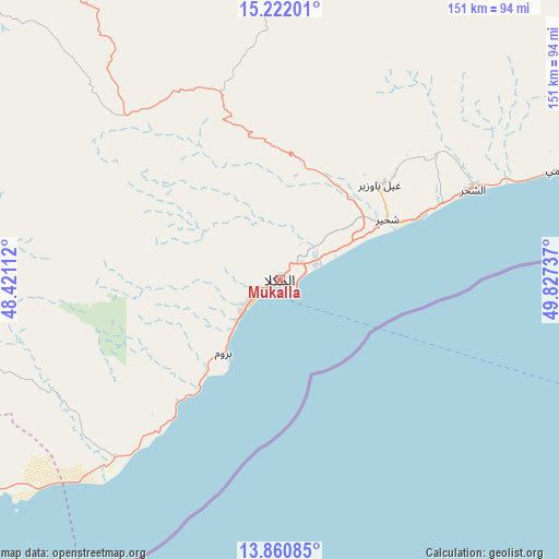
Mukalla GPS coordinates[2]
14° 32' 32.928" North, 49° 7' 27.264" East
| Map corner | latitude | longitude |
|---|---|---|
| Upper-left | 15.22201°, | 48.42112° |
| Center: | 14.54248°, | 49.12424° |
| Lower-right: | 13.86085°, | 49.82737° |
| Map W x H: | 151.3×151.4 km | = 94×94.1mi |
| max Lat: | 17.76999° ⇑58.1% North |
| Mukalla: | 14.54248° |
| min Lat: | ⇓41.9% South 12.18576° |
| min Long | Mukalla | max Long |
| 42.67107° | 49.12424° | 54.01895° |
| W 93.8%⇐ | ⇒6.2% E |
Elevation
Elevation of Mukalla is 39 m = 128 ft, and this is 1265.8 m = 4153 ft below average elevation for this country.
| Max E: |
2791 m = 9157 ft | 91.2% |
| Avg. | 1304.8 m = 4281 ft | |
| Mukalla | 39 m = 128 ft | |
Min E: |
4 m = 13 ft | 8.8% |
See also: Mukalla elevation on elevation.city.
Geographical zone
Mukalla is located in North Torrid zone (between Equator and Tropic of Cancer). Distance of this Northern Tropic circle is 988.9 km =614.5 mi to North.| Distance of | km | miles | from Mukalla |
|---|---|---|---|
| North Pole | 8390.1 | 5213.4 | to North |
| Arctic Circle | 5784.2 | 3594.1 | to North |
| Tropic Cancer | 988.9 | 614.5 | to North |
| Equator | 1617 | 1004.8 | to South |


Nearby cities:
15 places around Mukalla: (largest is in red/bold)
• Ad Dīs ash Sharqīyah
97.5 km =60.6 mi,  65°
65°
• Al Bāţinah
128.3 km =79.7 mi,  324°
324°
• Al Jawl
91.3 km =56.7 mi,  263°
263°
• Al Shirūj
146.6 km =91.1 mi,  276°
276°
• Al ‘Ulayb
67.5 km =41.9 mi,  355°
355°
• Ar Raydah
155.6 km =96.7 mi, 69°
• Ash Shiḩr
57.1 km =35.5 mi,  64°
64°
• Az̧ Z̧alī‘ah
130.2 km =80.9 mi,  293°
293°
• Burūm
25.3 km =15.7 mi,  218°
218°
• Ghayl Bā Wazīr
36.8 km =22.9 mi,  45°
45°
• Ruḑūm
157.2 km =97.7 mi,  251°
251°
• Sāh
118.7 km =73.8 mi,  345°
345°
• Şīf
121 km =75.2 mi, 315°
• Ḩurayḑah
154.9 km =96.3 mi, 319°
• ‘Amd
148.7 km =92.4 mi,  304°
304°
Sources, notices
• [Note1] Compared only with cities in Yemen existing in our database
• [Src1] Map data: © OpenStreetMap contributors (CC-BY-SA)
• [Src2] Other city data from geonames.org with taken over terms of usage.
• [Src3] Geographical zone / Annual Mean Temperature by Robert A. Rohde @ Wikipedia
