Somerset East geodata
Somerset East (Eastern Cape) is a seat of a third-order administrative division; located in South Africa in Africa/Johannesburg (GMT+2) time zone. With population of 16,155 people, there are 162 cities with bigger population in this country. Compared to other cities in South Africa, 82.6% of cities are located further ↑North; 71.1% of cities are located further →East and 68.1% of cities have higher elevation than Somerset East. Note1
Administrative division(s):
- Level 1: Eastern Cape
- Level 2: Cacadu District Municipality
- Level 3: Blue Crane Route


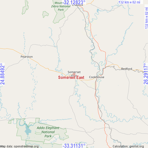
Somerset East GPS coordinates[2]
32° 43' 18.228" South, 25° 35' 16.944" East
| Map corner | latitude | longitude |
|---|---|---|
| Upper-left | -32.12823°, | 24.88492° |
| Center: | -32.72173°, | 25.58804° |
| Lower-right: | -33.31131°, | 26.29117° |
| Map W x H: | 131.5×131.5 km | = 81.7×81.7mi |
| max Lat: | -22.34881° ⇑82.6% North |
| Somerset East: | -32.72173° |
| min Lat: | ⇓17.4% South -34.66739° |
| min Long | Somerset East | max Long |
| 16.8697° | 25.58804° | 32.26762° |
| W 28.9%⇐ | ⇒71.1% E |
Elevation
Elevation of Somerset East is 748 m = 2454 ft, and this is 221.6 m = 727 ft below average elevation for this country.
| Max E: |
1873 m = 6145 ft | 68.1% |
| Avg. | 969.6 m = 3181 ft | |
| Somerset East | 748 m = 2454 ft | |
Min E: |
7 m = 23 ft | 31.9% |
See also: South Africa elevation on elevation.city.
Geographical zone
Somerset East is located in South temperate zone (between Tropic of Capricorn and the Antarctic Circle). Distance of this Southern Tropic circle is 1032.4 km =641.5 mi to North.| Distance of | km | miles | from Somerset East |
|---|---|---|---|
| Equator | 3638.3 | 2260.7 | to North |
| Tropic Capricorn | 1032.4 | 641.5 | to North |
| Antarctic Circle | 3762.9 | 2338.2 | to South |
| South Pole | 6368.7 | 3957.3 | to South |


Nearby cities:
15 places around Somerset East: (largest is in red/bold)
• Adelaide
66.2 km =41.1 mi,  88°
88°
• Alice
116.8 km =72.6 mi, 93°
• Cradock
62.1 km =38.6 mi,  2°
2°
• Fort Beaufort
98 km =60.9 mi, 93°
• Graaff-Reinet
112.1 km =69.7 mi,  297°
297°
• Grahamstown
109.3 km =67.9 mi,  126°
126°
• Jansenville
89 km =55.3 mi,  253°
253°
• Kirkwood
76.4 km =47.5 mi,  190°
190°
• Middelburg
147.2 km =91.5 mi,  338°
338°
• Peddie
152 km =94.4 mi,  110°
110°
• Port Elizabeth
137.8 km =85.6 mi,  178°
178°
• Queenstown
151.8 km =94.3 mi,  52°
52°
• Tarkastad
101.3 km =62.9 mi,  38°
38°
• Uitenhage
116.5 km =72.4 mi, 188°
• Whittlesea
130.9 km =81.3 mi,  62°
62°
Sources, notices
• [Note1] Compared only with cities in South Africa existing in our database
• [Src1] Map data: © OpenStreetMap contributors (CC-BY-SA)
• [Src2] Other city data from geonames.org with taken over terms of usage.
• [Src3] Geographical zone / Annual Mean Temperature by Robert A. Rohde @ Wikipedia
