Piet Retief geodata
Piet Retief (Mpumalanga) is a seat of a third-order administrative division; located in South Africa in Africa/Johannesburg (GMT+2) time zone. With population of 84,349 people, there are 63 cities with bigger population in this country. Compared to other cities in South Africa, 68.1% of cities are located further ↓South; 90.6% of cities are located further ←West and 59.9% of cities have lower elevation than Piet Retief. Note1
Administrative division(s):
- Level 1: Mpumalanga
- Level 2: Gert Sibande District Municipality
- Level 3: Mkhondo


Piet Retief GPS coordinates[2]
27° 0' 25.416" South, 30° 48' 47.628" East
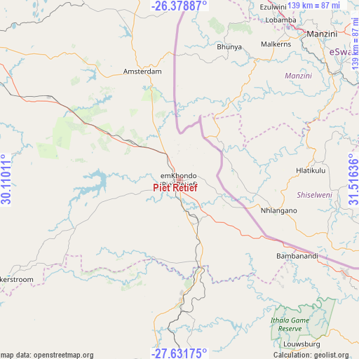
| Map corner | latitude | longitude |
|---|---|---|
| Upper-left | -26.37887°, | 30.11011° |
| Center: | -27.00706°, | 30.81323° |
| Lower-right: | -27.63175°, | 31.51636° |
| Map W x H: | 139.3×139.3 km | = 86.6×86.6mi |
| max Lat: | -22.34881° ⇑31.9% North |
| Piet Retief: | -27.00706° |
| min Lat: | ⇓68.1% South -34.66739° |
| min Long | Piet Retief | max Long |
| 16.8697° | 30.81323° | 32.26762° |
| W 90.6%⇐ | ⇒9.4% E |
Elevation
Elevation of Piet Retief is 1251 m = 4104 ft, and this is 281.4 m = 923 ft above average elevation for this country.
| Max E: |
1873 m = 6145 ft | 40.1% |
| Piet Retief | 1251 m 4104 ft | |
| Avg. | 969.6 m = 3181 ft | |
Min E: |
7 m = 23 ft | 59.9% |
See also: Piet Retief elevation on elevation.city.
Geographical zone
Piet Retief is located in South temperate zone (between Tropic of Capricorn and the Antarctic Circle). Distance of this Southern Tropic circle is 397 km =246.7 mi to North.| Distance of | km | miles | from Piet Retief |
|---|---|---|---|
| Equator | 3002.9 | 1865.9 | to North |
| Tropic Capricorn | 397 | 246.7 | to North |
| Antarctic Circle | 4398.3 | 2733 | to South |
| South Pole | 7004.2 | 4352.2 | to South |


Nearby cities:
15 places around Piet Retief: (largest is in red/bold)
• Barberton
137.6 km =85.5 mi,  10°
10°
• Breyten
113.5 km =70.5 mi,  313°
313°
• Carolina
125.3 km =77.9 mi,  326°
326°
• Dannhauser
134.6 km =83.6 mi,  213°
213°
• Driefontein
36 km =22.4 mi,  268°
268°
• Ermelo
97.8 km =60.8 mi,  302°
302°
• Jozini
132.5 km =82.3 mi,  110°
110°
• Mondlo
108.9 km =67.7 mi,  184°
184°
• Newcastle
120.6 km =74.9 mi,  226°
226°
• Nongoma
129.8 km =80.7 mi,  140°
140°
• Paulpietersburg
46.4 km =28.8 mi, 179°
• Pongola
89.7 km =55.7 mi,  117°
117°
• Utrecht
87.2 km =54.2 mi, 213°
• Volksrust
100.4 km =62.4 mi,  246°
246°
• Vryheid
84.8 km =52.7 mi, 181°
Sources, notices
• [Note1] Compared only with cities in South Africa existing in our database
• [Src1] Map data: © OpenStreetMap contributors (CC-BY-SA)
• [Src2] Other city data from geonames.org with taken over terms of usage.
• [Src3] Geographical zone / Annual Mean Temperature by Robert A. Rohde @ Wikipedia
