Driefontein geodata
Driefontein (Mpumalanga) is a populated place; located in South Africa in Africa/Johannesburg (GMT+2) time zone. With population of 28,127 people, there are 126 cities with bigger population in this country. Compared to other cities in South Africa, 67.6% of cities are located further ↓South; 86.7% of cities are located further ←West and 68.4% of cities have lower elevation than Driefontein. Note1
Administrative division(s):
- Level 1: Mpumalanga
- Level 2: Gert Sibande District Municipality
- Level 3: Mkhondo


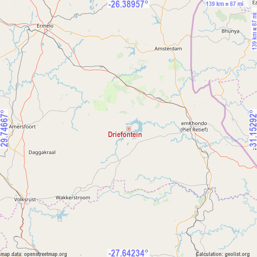
Driefontein GPS coordinates[2]
27° 1' 3.72" South, 30° 26' 59.244" East
| Map corner | latitude | longitude |
|---|---|---|
| Upper-left | -26.38957°, | 29.74667° |
| Center: | -27.0177°, | 30.44979° |
| Lower-right: | -27.64234°, | 31.15292° |
| Map W x H: | 139.3×139.3 km | = 86.6×86.6mi |
| max Lat: | -22.34881° ⇑32.4% North |
| Driefontein: | -27.0177° |
| min Lat: | ⇓67.6% South -34.66739° |
| min Long | Driefontein | max Long |
| 16.8697° | 30.44979° | 32.26762° |
| W 86.7%⇐ | ⇒13.3% E |
Elevation
Elevation of Driefontein is 1345 m = 4413 ft, and this is 375.4 m = 1232 ft above average elevation for this country.
| Max E: |
1873 m = 6145 ft | 31.6% |
| Driefontein | 1345 m 4413 ft | |
| Avg. | 969.6 m = 3181 ft | |
Min E: |
7 m = 23 ft | 68.4% |
See also: South Africa elevation on elevation.city.
Geographical zone
Driefontein is located in South temperate zone (between Tropic of Capricorn and the Antarctic Circle). Distance of this Southern Tropic circle is 398.2 km =247.4 mi to North.| Distance of | km | miles | from Driefontein |
|---|---|---|---|
| Equator | 3004.1 | 1866.7 | to North |
| Tropic Capricorn | 398.2 | 247.4 | to North |
| Antarctic Circle | 4397.1 | 2732.2 | to South |
| South Pole | 7003 | 4351.5 | to South |


Nearby cities:
15 places around Driefontein: (largest is in red/bold)
• Bethal
115.9 km =72 mi,  302°
302°
• Breyten
91.9 km =57.1 mi,  329°
329°
• Carolina
110.6 km =68.7 mi,  342°
342°
• Dannhauser
117.5 km =73 mi,  199°
199°
• Ermelo
71 km =44.1 mi,  319°
319°
• Hendrina
120.2 km =74.7 mi, 322°
• Mondlo
110.5 km =68.7 mi,  166°
166°
• Newcastle
96.9 km =60.2 mi,  211°
211°
• Paulpietersburg
58 km =36 mi,  141°
141°
• Piet Retief
36 km =22.4 mi,  88°
88°
• Pongola
122.4 km =76.1 mi,  109°
109°
• Standerton
120.1 km =74.6 mi,  274°
274°
• Utrecht
72.4 km =45 mi,  190°
190°
• Volksrust
68.2 km =42.4 mi,  235°
235°
• Vryheid
90.1 km =56 mi,  158°
158°
Sources, notices
• [Note1] Compared only with cities in South Africa existing in our database
• [Src1] Map data: © OpenStreetMap contributors (CC-BY-SA)
• [Src2] Other city data from geonames.org with taken over terms of usage.
• [Src3] Geographical zone / Annual Mean Temperature by Robert A. Rohde @ Wikipedia
