Paulpietersburg geodata
Paulpietersburg (KwaZulu-Natal) is a seat of a third-order administrative division; located in South Africa in Africa/Johannesburg (GMT+2) time zone. In our database, there are 257 cities with bigger population. Compared to other cities in South Africa, 64.3% of cities are located further ↓South; 90.9% of cities are located further ←West and 51.3% of cities have lower elevation than Paulpietersburg. Note1
Administrative division(s):
- Level 1: KwaZulu-Natal
- Level 2: Zululand District Municipality
- Level 3: eDumbe


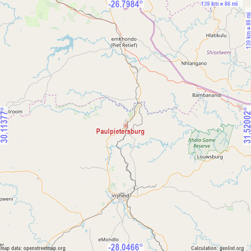
Paulpietersburg GPS coordinates[2]
27° 25' 27.336" South, 30° 49' 0.804" East
| Map corner | latitude | longitude |
|---|---|---|
| Upper-left | -26.7984°, | 30.11377° |
| Center: | -27.42426°, | 30.81689° |
| Lower-right: | -28.0466°, | 31.52002° |
| Map W x H: | 138.8×138.8 km | = 86.2×86.2mi |
| max Lat: | -22.34881° ⇑35.7% North |
| Paulpietersburg: | -27.42426° |
| min Lat: | ⇓64.3% South -34.66739° |
| min Long | Paulpietersburg | max Long |
| 16.8697° | 30.81689° | 32.26762° |
| W 90.9%⇐ | ⇒9.1% E |
Elevation
Elevation of Paulpietersburg is 1126 m = 3694 ft, and this is 156.4 m = 513 ft above average elevation for this country.
| Max E: |
1873 m = 6145 ft | 48.7% |
| Paulpietersburg | 1126 m 3694 ft | |
| Avg. | 969.6 m = 3181 ft | |
Min E: |
7 m = 23 ft | 51.3% |
See also: South Africa elevation on elevation.city.
Geographical zone
Paulpietersburg is located in South temperate zone (between Tropic of Capricorn and the Antarctic Circle). Distance of this Southern Tropic circle is 443.4 km =275.5 mi to North.| Distance of | km | miles | from Paulpietersburg |
|---|---|---|---|
| Equator | 3049.3 | 1894.7 | to North |
| Tropic Capricorn | 443.4 | 275.5 | to North |
| Antarctic Circle | 4351.9 | 2704.1 | to South |
| South Pole | 6957.8 | 4323.4 | to South |


Nearby cities:
15 places around Paulpietersburg: (largest is in red/bold)
• Dannhauser
99.6 km =61.9 mi,  228°
228°
• Driefontein
58 km =36 mi,  321°
321°
• Dundee
100.5 km =62.4 mi,  214°
214°
• Glencoe
106.6 km =66.2 mi,  218°
218°
• Jozini
123.3 km =76.6 mi,  90°
90°
• Mkuze
122.4 km =76.1 mi,  100°
100°
• Mondlo
62.9 km =39.1 mi,  188°
188°
• Newcastle
94.8 km =58.9 mi,  246°
246°
• Nongoma
98.1 km =61 mi,  123°
123°
• Piet Retief
46.4 km =28.8 mi,  359°
359°
• Pongola
79.4 km =49.3 mi, 86°
• Ulundi
117.2 km =72.8 mi,  149°
149°
• Utrecht
55.3 km =34.4 mi,  241°
241°
• Volksrust
92.5 km =57.5 mi,  274°
274°
• Vryheid
38.5 km =23.9 mi,  183°
183°
Sources, notices
• [Note1] Compared only with cities in South Africa existing in our database
• [Src1] Map data: © OpenStreetMap contributors (CC-BY-SA)
• [Src2] Other city data from geonames.org with taken over terms of usage.
• [Src3] Geographical zone / Annual Mean Temperature by Robert A. Rohde @ Wikipedia
