Baghlān geodata
Baghlān (Baghlan) is a seat of a second-order administrative division; located in Afghanistan in Asia/Kabul (GMT+4.5) time zone. With population of 108,449 people, there are 8 cities with bigger population in this country. Compared to other cities in Afghanistan, 78.5% of cities are located further ↓South; 52.4% of cities are located further ←West and 86.5% of cities have higher elevation than Baghlān. Note1


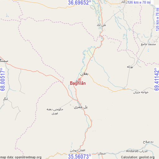
Baghlān GPS coordinates[2]
36° 7' 50.448" North, 68° 42' 29.844" East
| Map corner | latitude | longitude |
|---|---|---|
| Upper-left | 36.69652°, | 68.00517° |
| Center: | 36.13068°, | 68.70829° |
| Lower-right: | 35.56073°, | 69.41142° |
| Map W x H: | 126.3×126.3 km | = 78.5×78.5mi |
| max Lat: | 38.4435° ⇑21.5% North |
| Baghlān: | 36.13068° |
| min Lat: | ⇓78.5% South 30.15° |
| min Long | Baghlān | max Long |
| 61.06667° | 68.70829° | 72.318° |
| W 52.4%⇐ | ⇒47.6% E |
Elevation
Elevation of Baghlān is 531 m = 1742 ft, and this is 887.4 m = 2911 ft below average elevation for this country.
| Max E: |
3068 m = 10066 ft | 86.5% |
| Avg. | 1418.4 m = 4654 ft | |
| Baghlān | 531 m = 1742 ft | |
Min E: |
254 m = 833 ft | 13.5% |
See also: Baghlān elevation on elevation.city.
Geographical zone
Baghlān is located in North temperate zone (between Tropic of Cancer and the Arctic Circle). Distance of this Northern Tropic circle is 1411.4 km =877 mi to South.| Distance of | km | miles | from Baghlān |
|---|---|---|---|
| North Pole | 5989.7 | 3721.8 | to North |
| Arctic Circle | 3383.8 | 2102.6 | to North |
| Tropic Cancer | 1411.4 | 877 | to South |
| Equator | 4017.4 | 2496.3 | to South |


Nearby cities:
15 places around Baghlān: (largest is in red/bold)
• Afaki
82.4 km =51.2 mi,  44°
44°
• Aliabad
46.7 km =29 mi,  21°
21°
• Aībak
63.9 km =39.7 mi,  283°
283°
• Banū
74.4 km =46.2 mi,  138°
138°
• Būrkah
41 km =25.5 mi,  75°
75°
• Deh-e Şalāḩ
73.4 km =45.6 mi,  131°
131°
• Dowr-e Rabāţ
62.8 km =39 mi,  6°
6°
• Dōshī
58 km =36 mi,  182°
182°
• Khanabad
71.4 km =44.4 mi,  30°
30°
• Khinjān
62.7 km =39 mi,  163°
163°
• Kunduz
67.8 km =42.1 mi, 11°
• Langar
61 km =37.9 mi,  255°
255°
• Nahrīn
38.9 km =24.2 mi,  100°
100°
• Pul-e Khumrī
20.7 km =12.9 mi, 178°
• Ḩukūmatī Dahanah-ye Ghōrī
31.8 km =19.8 mi,  218°
218°
Sources, notices
• [Note1] Compared only with cities in Afghanistan existing in our database
• [Src1] Map data: © OpenStreetMap contributors (CC-BY-SA)
• [Src2] Other city data from geonames.org with taken over terms of usage.
• [Src3] Geographical zone / Annual Mean Temperature by Robert A. Rohde @ Wikipedia
