Langar geodata
Langar (Samangan) is a seat of a second-order administrative division; located in Afghanistan in Asia/Kabul (GMT+4.5) time zone. In our database, there are 93 cities with bigger population. Compared to other cities in Afghanistan, 76.5% of cities are located further ↓South; 54.3% of cities are located further →East and 52.4% of cities have lower elevation than Langar. Note1


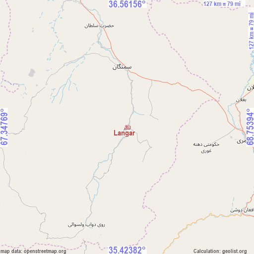
Langar GPS coordinates[2]
35° 59' 41.064" North, 68° 3' 2.916" East
| Map corner | latitude | longitude |
|---|---|---|
| Upper-left | 36.56156°, | 67.34769° |
| Center: | 35.99474°, | 68.05081° |
| Lower-right: | 35.42382°, | 68.75394° |
| Map W x H: | 126.5×126.5 km | = 78.6×78.6mi |
| max Lat: | 38.4435° ⇑23.5% North |
| Langar: | 35.99474° |
| min Lat: | ⇓76.5% South 30.15° |
| min Long | Langar | max Long |
| 61.06667° | 68.05081° | 72.318° |
| W 45.7%⇐ | ⇒54.3% E |
Elevation
Elevation of Langar is 1440 m = 4724 ft, and this is 21.6 m = 71 ft above average elevation for this country.
| Max E: |
3068 m = 10066 ft | 47.6% |
| Langar | 1440 m 4724 ft | |
| Avg. | 1418.4 m = 4654 ft | |
Min E: |
254 m = 833 ft | 52.4% |
See also: Afghanistan elevation on elevation.city.
Geographical zone
Langar is located in North temperate zone (between Tropic of Cancer and the Arctic Circle). Distance of this Northern Tropic circle is 1396.3 km =867.6 mi to South.| Distance of | km | miles | from Langar |
|---|---|---|---|
| North Pole | 6004.8 | 3731.2 | to North |
| Arctic Circle | 3398.9 | 2112 | to North |
| Tropic Cancer | 1396.3 | 867.6 | to South |
| Equator | 4002.2 | 2486.9 | to South |


Nearby cities:
15 places around Langar: (largest is in red/bold)
• Aliabad
96 km =59.7 mi,  52°
52°
• Aībak
30.2 km =18.8 mi,  353°
353°
• Baghlān
61 km =37.9 mi,  75°
75°
• Bāzār-e Tālah
68.8 km =42.8 mi,  166°
166°
• Dehī
69.5 km =43.2 mi,  266°
266°
• Dowr-e Rabāţ
101.9 km =63.3 mi,  40°
40°
• Dōshī
71.5 km =44.4 mi,  126°
126°
• Dūāb
52.3 km =32.5 mi,  203°
203°
• Khinjān
89 km =55.3 mi,  120°
120°
• Khudāydād Khēl
96.5 km =60 mi, 199°
• Khulm
84.3 km =52.4 mi,  337°
337°
• Nahrīn
97.7 km =60.7 mi,  85°
85°
• Pul-e Khumrī
60 km =37.3 mi,  95°
95°
• Rū-ye Sang
83.9 km =52.1 mi,  206°
206°
• Ḩukūmatī Dahanah-ye Ghōrī
40.6 km =25.2 mi, 104°
Sources, notices
• [Note1] Compared only with cities in Afghanistan existing in our database
• [Src1] Map data: © OpenStreetMap contributors (CC-BY-SA)
• [Src2] Other city data from geonames.org with taken over terms of usage.
• [Src3] Geographical zone / Annual Mean Temperature by Robert A. Rohde @ Wikipedia
