Tsaghkadzor geodata
Tsaghkadzor (Kotayk) is a populated place; located in Armenia in Asia/Yerevan (GMT+4) time zone. With population of 1,407 people, there are 230 cities with bigger population in this country. Compared to other cities in Armenia, 69.4% of cities are located further ↓South; 67.8% of cities are located further ←West and 85% of cities have lower elevation than Tsaghkadzor. Note1


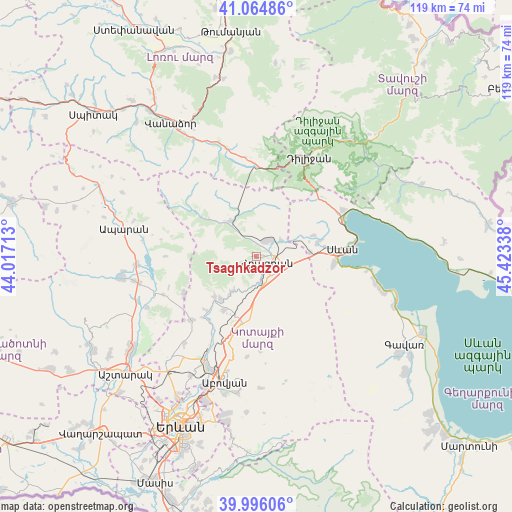
Tsaghkadzor GPS coordinates[2]
40° 31' 57.324" North, 44° 43' 12.9" East
| Map corner | latitude | longitude |
|---|---|---|
| Upper-left | 41.06486°, | 44.01713° |
| Center: | 40.53259°, | 44.72025° |
| Lower-right: | 39.99606°, | 45.42338° |
| Map W x H: | 118.8×118.8 km | = 73.8×73.8mi |
| max Lat: | 41.24358° ⇑30.6% North |
| Tsaghkadzor: | 40.53259° |
| min Lat: | ⇓69.4% South 38.90292° |
| min Long | Tsaghkadzor | max Long |
| 43.74722° | 44.72025° | 46.5446° |
| W 67.8%⇐ | ⇒32.2% E |
Elevation
Elevation of Tsaghkadzor is 1861 m = 6106 ft, and this is 559.5 m = 1836 ft above average elevation for this country.
| Max E: |
2169 m = 7116 ft | 15% |
| Tsaghkadzor | 1861 m 6106 ft | |
| Avg. | 1301.5 m = 4270 ft | |
Min E: |
440 m = 1444 ft | 85% |
See also: Armenia elevation on elevation.city.
Geographical zone
Tsaghkadzor is located in North temperate zone (between Tropic of Cancer and the Arctic Circle). Distance of this Northern Tropic circle is 1900.9 km =1181.2 mi to South.| Distance of | km | miles | from Tsaghkadzor |
|---|---|---|---|
| North Pole | 5500.3 | 3417.7 | to North |
| Arctic Circle | 2894.4 | 1798.5 | to North |
| Tropic Cancer | 1900.9 | 1181.2 | to South |
| Equator | 4506.8 | 2800.4 | to South |


Nearby cities:
15 places around Tsaghkadzor: (largest is in red/bold)
• Aghavnadzor
5.9 km =3.7 mi,  339°
339°
• Arzakan
13.2 km =8.2 mi,  225°
225°
• Bjni
10.2 km =6.3 mi,  215°
215°
• Ddmashen
9.6 km =6 mi,  64°
64°
• Fantan
15.6 km =9.7 mi,  190°
190°
• Gagarin
12.7 km =7.9 mi,  86°
86°
• Geghamavan
14.6 km =9.1 mi,  76°
76°
• Hrazdan
5.5 km =3.4 mi,  135°
135°
• Lchashen
17.8 km =11.1 mi, 94°
• Lerrnanist
9.5 km =5.9 mi, 140°
• Meghradzor
10 km =6.2 mi,  324°
324°
• Sevan
18.8 km =11.7 mi, 85°
• Solak
7.9 km =4.9 mi, 188°
• Varser
16.1 km =10 mi, 80°
• Zovaber
7 km =4.3 mi, 57°
Sources, notices
• [Note1] Compared only with cities in Armenia existing in our database
• [Src1] Map data: © OpenStreetMap contributors (CC-BY-SA)
• [Src2] Other city data from geonames.org with taken over terms of usage.
• [Src3] Geographical zone / Annual Mean Temperature by Robert A. Rohde @ Wikipedia
