Meghradzor geodata
Meghradzor (Kotayk) is a populated place; located in Armenia in Asia/Yerevan (GMT+4) time zone. With population of 2,659 people, there are 108 cities with bigger population in this country. Compared to other cities in Armenia, 74.5% of cities are located further ↓South; 62.1% of cities are located further ←West and 80.9% of cities have lower elevation than Meghradzor. Note1


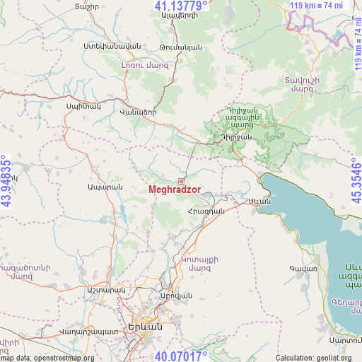
Meghradzor GPS coordinates[2]
40° 36' 21.996" North, 44° 39' 5.292" East
| Map corner | latitude | longitude |
|---|---|---|
| Upper-left | 41.13779°, | 43.94835° |
| Center: | 40.60611°, | 44.65147° |
| Lower-right: | 40.07017°, | 45.3546° |
| Map W x H: | 118.7×118.7 km | = 73.8×73.8mi |
| max Lat: | 41.24358° ⇑25.5% North |
| Meghradzor: | 40.60611° |
| min Lat: | ⇓74.5% South 38.90292° |
| min Long | Meghradzor | max Long |
| 43.74722° | 44.65147° | 46.5446° |
| W 62.1%⇐ | ⇒37.9% E |
Elevation
Elevation of Meghradzor is 1785 m = 5856 ft, and this is 483.5 m = 1586 ft above average elevation for this country.
| Max E: |
2169 m = 7116 ft | 19.1% |
| Meghradzor | 1785 m 5856 ft | |
| Avg. | 1301.5 m = 4270 ft | |
Min E: |
440 m = 1444 ft | 80.9% |
See also: Armenia elevation on elevation.city.
Geographical zone
Meghradzor is located in North temperate zone (between Tropic of Cancer and the Arctic Circle). Distance of this Northern Tropic circle is 1909.1 km =1186.3 mi to South.| Distance of | km | miles | from Meghradzor |
|---|---|---|---|
| North Pole | 5492.1 | 3412.6 | to North |
| Arctic Circle | 2886.2 | 1793.4 | to North |
| Tropic Cancer | 1909.1 | 1186.3 | to South |
| Equator | 4515 | 2805.5 | to South |


Nearby cities:
15 places around Meghradzor: (largest is in red/bold)
• Aghavnadzor
4.6 km =2.9 mi,  125°
125°
• Arzakan
17.7 km =11 mi,  191°
191°
• Bjni
16.4 km =10.2 mi,  180°
180°
• Buzhakan
20.1 km =12.5 mi,  213°
213°
• Ddmashen
15 km =9.3 mi,  105°
105°
• Fioletovo
14.1 km =8.8 mi,  23°
23°
• Gagarin
19.8 km =12.3 mi, 111°
• Geghamavan
20.6 km =12.8 mi,  103°
103°
• Hrazdan
15.5 km =9.6 mi,  141°
141°
• Lerrnanist
19.5 km =12.1 mi, 142°
• Margahovit
14.5 km =9 mi,  11°
11°
• Solak
16.6 km =10.3 mi,  163°
163°
• Tsaghkadzor
10 km =6.2 mi, 144°
• Zovaber
12.5 km =7.8 mi, 110°
• Zovuni
20.8 km =12.9 mi,  239°
239°
Sources, notices
• [Note1] Compared only with cities in Armenia existing in our database
• [Src1] Map data: © OpenStreetMap contributors (CC-BY-SA)
• [Src2] Other city data from geonames.org with taken over terms of usage.
• [Src3] Geographical zone / Annual Mean Temperature by Robert A. Rohde @ Wikipedia
