Arzakan geodata
Arzakan (Kotayk) is a populated place; located in Armenia in Asia/Yerevan (GMT+4) time zone. With population of 2,660 people, there are 107 cities with bigger population in this country. Compared to other cities in Armenia, 65.3% of cities are located further ↓South; 58.3% of cities are located further ←West and 61.5% of cities have lower elevation than Arzakan. Note1


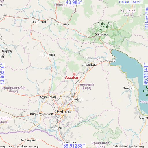
Arzakan GPS coordinates[2]
40° 27' 0.252" North, 44° 36' 29.808" East
| Map corner | latitude | longitude |
|---|---|---|
| Upper-left | 40.983°, | 43.90516° |
| Center: | 40.45007°, | 44.60828° |
| Lower-right: | 39.91288°, | 45.31141° |
| Map W x H: | 119×119 km | = 73.9×73.9mi |
| max Lat: | 41.24358° ⇑34.7% North |
| Arzakan: | 40.45007° |
| min Lat: | ⇓65.3% South 38.90292° |
| min Long | Arzakan | max Long |
| 43.74722° | 44.60828° | 46.5446° |
| W 58.3%⇐ | ⇒41.7% E |
Elevation
Elevation of Arzakan is 1483 m = 4865 ft, and this is 181.5 m = 595 ft above average elevation for this country.
| Max E: |
2169 m = 7116 ft | 38.5% |
| Arzakan | 1483 m 4865 ft | |
| Avg. | 1301.5 m = 4270 ft | |
Min E: |
440 m = 1444 ft | 61.5% |
See also: Armenia elevation on elevation.city.
Geographical zone
Arzakan is located in North temperate zone (between Tropic of Cancer and the Arctic Circle). Distance of this Northern Tropic circle is 1891.7 km =1175.4 mi to South.| Distance of | km | miles | from Arzakan |
|---|---|---|---|
| North Pole | 5509.4 | 3423.4 | to North |
| Arctic Circle | 2903.5 | 1804.2 | to North |
| Tropic Cancer | 1891.7 | 1175.4 | to South |
| Equator | 4497.6 | 2794.7 | to South |


Nearby cities:
15 places around Arzakan: (largest is in red/bold)
• Aghavnadzor
16.4 km =10.2 mi,  26°
26°
• Aragyugh
7.5 km =4.7 mi,  225°
225°
• Argel
8.1 km =5 mi,  184°
184°
• Bjni
3.7 km =2.3 mi,  75°
75°
• Buzhakan
7.5 km =4.7 mi,  274°
274°
• Byureghavan
15.2 km =9.4 mi, 184°
• Fantan
9 km =5.6 mi,  133°
133°
• Hrazdan
14.4 km =8.9 mi,  68°
68°
• Kaputan
15.9 km =9.9 mi,  150°
150°
• Lerrnanist
15.7 km =9.8 mi, 83°
• Nor Geghi
14.4 km =8.9 mi,  188°
188°
• Solak
8.5 km =5.3 mi, 80°
• Tsaghkadzor
13.2 km =8.2 mi,  45°
45°
• Zoravan
12.8 km =8 mi,  214°
214°
• Zovuni
15.9 km =9.9 mi,  295°
295°
Sources, notices
• [Note1] Compared only with cities in Armenia existing in our database
• [Src1] Map data: © OpenStreetMap contributors (CC-BY-SA)
• [Src2] Other city data from geonames.org with taken over terms of usage.
• [Src3] Geographical zone / Annual Mean Temperature by Robert A. Rohde @ Wikipedia
