Margahovit geodata
Margahovit (Lori) is a populated place; located in Armenia in Asia/Yerevan (GMT+4) time zone. With population of 3,308 people, there are 82 cities with bigger population in this country. Compared to other cities in Armenia, 79.9% of cities are located further ↓South; 65.3% of cities are located further ←West and 77.7% of cities have lower elevation than Margahovit. Note1


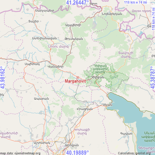
Margahovit GPS coordinates[2]
40° 44' 1.716" North, 44° 41' 5.064" East
| Map corner | latitude | longitude |
|---|---|---|
| Upper-left | 41.26447°, | 43.98162° |
| Center: | 40.73381°, | 44.68474° |
| Lower-right: | 40.19889°, | 45.38787° |
| Map W x H: | 118.5×118.5 km | = 73.6×73.6mi |
| max Lat: | 41.24358° ⇑20.1% North |
| Margahovit: | 40.73381° |
| min Lat: | ⇓79.9% South 38.90292° |
| min Long | Margahovit | max Long |
| 43.74722° | 44.68474° | 46.5446° |
| W 65.3%⇐ | ⇒34.7% E |
Elevation
Elevation of Margahovit is 1752 m = 5748 ft, and this is 450.5 m = 1478 ft above average elevation for this country.
| Max E: |
2169 m = 7116 ft | 22.3% |
| Margahovit | 1752 m 5748 ft | |
| Avg. | 1301.5 m = 4270 ft | |
Min E: |
440 m = 1444 ft | 77.7% |
See also: Armenia elevation on elevation.city.
Geographical zone
Margahovit is located in North temperate zone (between Tropic of Cancer and the Arctic Circle). Distance of this Northern Tropic circle is 1923.3 km =1195.1 mi to South.| Distance of | km | miles | from Margahovit |
|---|---|---|---|
| North Pole | 5477.9 | 3403.8 | to North |
| Arctic Circle | 2872 | 1784.6 | to North |
| Tropic Cancer | 1923.3 | 1195.1 | to South |
| Equator | 4529.2 | 2814.3 | to South |


Nearby cities:
15 places around Margahovit: (largest is in red/bold)
• Aghavnadzor
16.9 km =10.5 mi,  176°
176°
• Darpas
24.7 km =15.3 mi,  297°
297°
• Ddmashen
21.6 km =13.4 mi,  147°
147°
• Dilijan
14 km =8.7 mi,  86°
86°
• Fioletovo
3.1 km =1.9 mi,  114°
114°
• Gugark’
14.5 km =9 mi, 302°
• Haghartsin
24.4 km =15.2 mi,  78°
78°
• Lorut
23.8 km =14.8 mi,  17°
17°
• Meghradzor
14.5 km =9 mi,  191°
191°
• Shahumyan
12.5 km =7.8 mi,  291°
291°
• Tsaghkadzor
22.6 km =14 mi,  172°
172°
• Vahagni
20.3 km =12.6 mi,  341°
341°
• Vanadzor
17.9 km =11.1 mi, 296°
• Yeghegnut
19.3 km =12 mi,  346°
346°
• Zovaber
20.6 km =12.8 mi, 154°
Sources, notices
• [Note1] Compared only with cities in Armenia existing in our database
• [Src1] Map data: © OpenStreetMap contributors (CC-BY-SA)
• [Src2] Other city data from geonames.org with taken over terms of usage.
• [Src3] Geographical zone / Annual Mean Temperature by Robert A. Rohde @ Wikipedia
