Alpachiri geodata
Alpachiri (La Pampa) is a populated place; located in Argentina in America/Argentina/Salta (GMT-3) time zone. With population of 2,138 people, there are 628 cities with bigger population in this country. Compared to other cities in Argentina, 86.9% of cities are located further ↑North; 58.8% of cities are located further →East and 52.4% of cities have lower elevation than Alpachiri. Note1


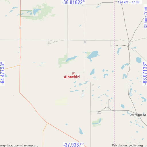
Alpachiri GPS coordinates[2]
37° 22' 37.344" South, 63° 46' 28.02" West
| Map corner | latitude | longitude |
|---|---|---|
| Upper-left | -36.81622°, | -64.47758° |
| Center: | -37.37704°, | -63.77445° |
| Lower-right: | -37.9337°, | -63.07133° |
| Map W x H: | 124.3×124.3 km | = 77.2×77.2mi |
| max Lat: | -21.94467° ⇑86.9% North |
| Alpachiri: | -37.37704° |
| min Lat: | ⇓13.1% South -54.81084° |
| min Long | Alpachiri | max Long |
| -72.88605° | -63.77445° | -53.64581° |
| W 41.2%⇐ | ⇒58.8% E |
Elevation
Elevation of Alpachiri is 161 m = 528 ft, and this is 188.3 m = 618 ft below average elevation for this country.
| Max E: |
4040 m = 13255 ft | 47.6% |
| Avg. | 349.3 m = 1146 ft | |
| Alpachiri | 161 m = 528 ft | |
Min E: |
-2 m = -7 ft | 52.4% |
See also: Argentina elevation on elevation.city.
Geographical zone
Alpachiri is located in South temperate zone (between Tropic of Capricorn and the Antarctic Circle). Distance of this Southern Tropic circle is 1550 km =963.1 mi to North.| Distance of | km | miles | from Alpachiri |
|---|---|---|---|
| Equator | 4155.9 | 2582.4 | to North |
| Tropic Capricorn | 1550 | 963.1 | to North |
| Antarctic Circle | 3245.2 | 2016.5 | to South |
| South Pole | 5851.1 | 3635.7 | to South |


Nearby cities:
15 places around Alpachiri: (largest is in red/bold)
• Anguil
97 km =60.3 mi,  347°
347°
• Ataliva Roca
59.3 km =36.8 mi,  310°
310°
• Bernasconi
58.7 km =36.5 mi,  177°
177°
• Carhué
92.7 km =57.6 mi,  76°
76°
• Doblas
32.9 km =20.4 mi,  320°
320°
• General Acha
73.3 km =45.5 mi,  270°
270°
• General Manuel J. Campos
19.1 km =11.9 mi,  118°
118°
• General San Martín
68.6 km =42.6 mi,  167°
167°
• Guatraché
38.8 km =24.1 mi,  146°
146°
• Jacinto Arauz
84.4 km =52.4 mi,  159°
159°
• Macachín
28.5 km =17.7 mi,  19°
19°
• Miguel Riglos
58.7 km =36.5 mi,  7°
7°
• Puan
90.9 km =56.5 mi,  101°
101°
• Santa Rosa
95.9 km =59.6 mi,  331°
331°
• Toay
94.9 km =59 mi, 325°
Sources, notices
• [Note1] Compared only with cities in Argentina existing in our database
• [Src1] Map data: © OpenStreetMap contributors (CC-BY-SA)
• [Src2] Other city data from geonames.org with taken over terms of usage.
• [Src3] Geographical zone / Annual Mean Temperature by Robert A. Rohde @ Wikipedia
