General Acha geodata
General Acha (La Pampa) is a seat of a second-order administrative division; located in Argentina in America/Argentina/Salta (GMT-3) time zone. With population of 12,536 people, there are 250 cities with bigger population in this country. Compared to other cities in Argentina, 86.8% of cities are located further ↑North; 69.8% of cities are located further →East and 61.8% of cities have lower elevation than General Acha. Note1


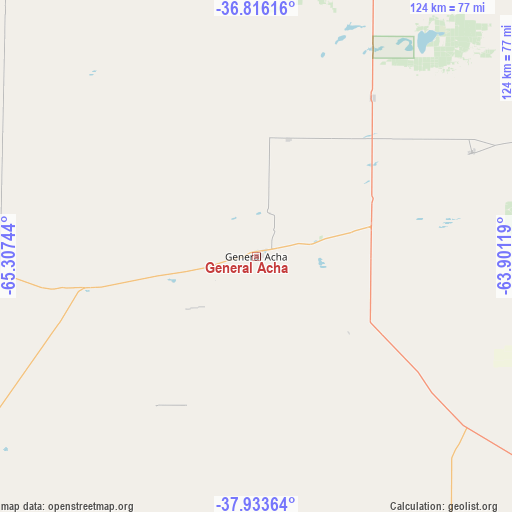
General Acha GPS coordinates[2]
37° 22' 37.128" South, 64° 36' 15.516" West
| Map corner | latitude | longitude |
|---|---|---|
| Upper-left | -36.81616°, | -65.30744° |
| Center: | -37.37698°, | -64.60431° |
| Lower-right: | -37.93364°, | -63.90119° |
| Map W x H: | 124.3×124.3 km | = 77.2×77.2mi |
| max Lat: | -21.94467° ⇑86.8% North |
| General Acha: | -37.37698° |
| min Lat: | ⇓13.2% South -54.81084° |
| min Long | General Acha | max Long |
| -72.88605° | -64.60431° | -53.64581° |
| W 30.2%⇐ | ⇒69.8% E |
Elevation
Elevation of General Acha is 230 m = 755 ft, and this is 119.3 m = 391 ft below average elevation for this country.
| Max E: |
4040 m = 13255 ft | 38.2% |
| Avg. | 349.3 m = 1146 ft | |
| General Acha | 230 m = 755 ft | |
Min E: |
-2 m = -7 ft | 61.8% |
See also: Argentina elevation on elevation.city.
Geographical zone
General Acha is located in South temperate zone (between Tropic of Capricorn and the Antarctic Circle). Distance of this Southern Tropic circle is 1550 km =963.1 mi to North.| Distance of | km | miles | from General Acha |
|---|---|---|---|
| Equator | 4155.9 | 2582.4 | to North |
| Tropic Capricorn | 1550 | 963.1 | to North |
| Antarctic Circle | 3245.2 | 2016.5 | to South |
| South Pole | 5851.1 | 3635.7 | to South |


Nearby cities:
15 places around General Acha: (largest is in red/bold)
• Alpachiri
73.3 km =45.5 mi,  90°
90°
• Anguil
108.4 km =67.4 mi,  29°
29°
• Ataliva Roca
47.7 km =29.6 mi,  36°
36°
• Bernasconi
95.9 km =59.6 mi,  127°
127°
• Cuchillo Có
106.4 km =66.1 mi,  181°
181°
• Doblas
58.2 km =36.2 mi,  64°
64°
• General Manuel J. Campos
90.5 km =56.2 mi,  95°
95°
• General San Martín
110.6 km =68.7 mi, 127°
• Guatraché
100.1 km =62.2 mi,  108°
108°
• Jacinto Arauz
129.8 km =80.7 mi, 127°
• Macachín
87.2 km =54.2 mi,  72°
72°
• Miguel Riglos
99.9 km =62.1 mi,  54°
54°
• Santa Rosa
89.2 km =55.4 mi,  18°
18°
• Toay
80.8 km =50.2 mi,  14°
14°
• Uriburu
117.1 km =72.8 mi, 34°
Sources, notices
• [Note1] Compared only with cities in Argentina existing in our database
• [Src1] Map data: © OpenStreetMap contributors (CC-BY-SA)
• [Src2] Other city data from geonames.org with taken over terms of usage.
• [Src3] Geographical zone / Annual Mean Temperature by Robert A. Rohde @ Wikipedia
