General Manuel J. Campos geodata
General Manuel J. Campos (La Pampa) is a populated place; located in Argentina in America/Argentina/Salta (GMT-3) time zone. With population of 1,016 people, there are 768 cities with bigger population in this country. Compared to other cities in Argentina, 87.4% of cities are located further ↑North; 56.7% of cities are located further →East and 52.1% of cities have lower elevation than General Manuel J. Campos. Note1
Current local time in General Manuel J. Campos:
09:21 AM, SaturdayDifference from your time zone: hours


General Manuel J. Campos GPS coordinates[2]
37° 27' 36.9" South, 63° 35' 7.332" West
| Map corner | latitude | longitude |
|---|---|---|
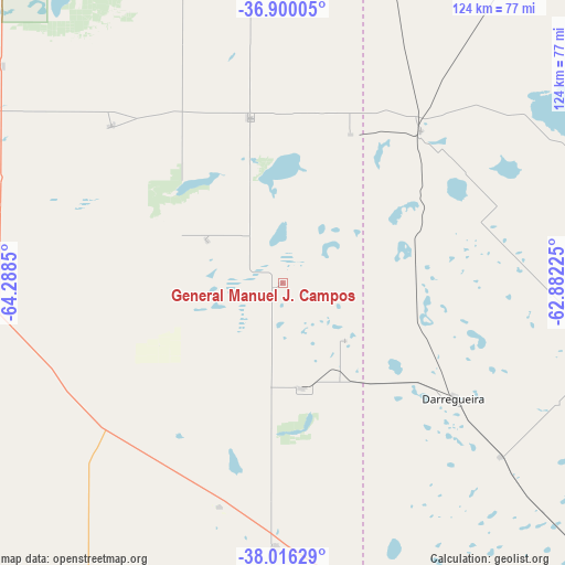
| Upper-left | -36.90005°, | -64.2885° |
| Center: | -37.46025°, | -63.58537° |
| Lower-right: | -38.01629°, | -62.88225° |
| Map W x H: | 124.1×124.1 km | = 77.1×77.1mi |
| max Lat: | -21.94467° ⇑87.4% North |
| General Manuel J. Campos: | -37.46025° |
| min Lat: | ⇓12.6% South -54.81084° |
| min Long | General Manuel | max Long |
| -72.88605° | -63.58537° | -53.64581° |
| W 43.3%⇐ | ⇒56.7% E |
Elevation
Elevation of General Manuel J. Campos is 159 m = 522 ft, and this is 190.3 m = 624 ft below average elevation for this country.
| Max E: |
4040 m = 13255 ft | 47.9% |
| Avg. | 349.3 m = 1146 ft | |
| General Manuel J. Campos | 159 m = 522 ft | |
Min E: |
-2 m = -7 ft | 52.1% |
See also: Argentina elevation on elevation.city.
Geographical zone
General Manuel J. Campos is located in South temperate zone (between Tropic of Capricorn and the Antarctic Circle). Distance of this Southern Tropic circle is 1559.3 km =968.9 mi to North.| Distance of | km | miles | from General Manuel J. Campos |
|---|---|---|---|
| Equator | 4165.2 | 2588.1 | to North |
| Tropic Capricorn | 1559.3 | 968.9 | to North |
| Antarctic Circle | 3236 | 2010.8 | to South |
| South Pole | 5841.9 | 3630 | to South |


Nearby cities:
15 places around General Manuel J. Campos: (largest is in red/bold)
• Alpachiri
19.1 km =11.9 mi,  298°
298°
• Ataliva Roca
78.1 km =48.5 mi,  307°
307°
• Bernasconi
51.3 km =31.9 mi,  195°
195°
• Carhué
79.7 km =49.5 mi,  66°
66°
• Doblas
51.1 km =31.8 mi, 312°
• General Acha
90.5 km =56.2 mi,  275°
275°
• General San Martín
57.7 km =35.9 mi,  181°
181°
• Guatraché
23.6 km =14.7 mi,  168°
168°
• Jacinto Arauz
70.9 km =44.1 mi, 169°
• Macachín
36.8 km =22.9 mi,  348°
348°
• Miguel Riglos
68 km =42.3 mi, 352°
• Pigüé
105.5 km =65.6 mi,  98°
98°
• Puan
72.8 km =45.2 mi, 97°
• Salliqueló
96.3 km =59.8 mi,  35°
35°
• Uriburu
108.8 km =67.6 mi, 346°
Sources, notices
• [Note1] Compared only with cities in Argentina existing in our database
• [Src1] Map data: © OpenStreetMap contributors (CC-BY-SA)
• [Src2] Other city data from geonames.org with taken over terms of usage.
• [Src3] Geographical zone / Annual Mean Temperature by Robert A. Rohde @ Wikipedia
