Krumau am Kamp geodata
Krumau am Kamp (Lower Austria) is a seat of a third-order administrative division; located in Austria in Europe/Vienna (GMT+2) time zone. With population of 256 people, there are 2802 cities with bigger population in this country. Compared to other cities in Austria, 96.4% of cities are located further ↓South; 63.8% of cities are located further ←West and 62.5% of cities have higher elevation than Krumau am Kamp. Note1
Administrative division(s):
- Level 1: Lower Austria
- Level 2: Politischer Bezirk Krems
- Level 3: Krumau am Kamp


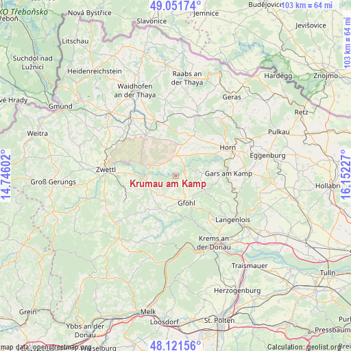
Krumau am Kamp GPS coordinates[2]
48° 35' 19.644" North, 15° 26' 56.904" East
| Map corner | latitude | longitude |
|---|---|---|
| Upper-left | 49.05174°, | 14.74602° |
| Center: | 48.58879°, | 15.44914° |
| Lower-right: | 48.12156°, | 16.15227° |
| Map W x H: | 103.4×103.4 km | = 64.2×64.2mi |
| max Lat: | 48.98333° ⇑3.6% North |
| Krumau am Kamp: | 48.58879° |
| min Lat: | ⇓96.4% South 46.48841° |
| min Long | Krumau am Kamp | max Long |
| 9.57802° | 15.44914° | 17.1° |
| W 63.8%⇐ | ⇒36.2% E |
Elevation
Elevation of Krumau am Kamp is 368 m = 1207 ft, and this is 137.5 m = 451 ft below average elevation for this country.
| Max E: |
2140 m = 7021 ft | 62.5% |
| Avg. | 505.5 m = 1658 ft | |
| Krumau am Kamp | 368 m = 1207 ft | |
Min E: |
118 m = 387 ft | 37.5% |
See also: Austria elevation on elevation.city.
Geographical zone
Krumau am Kamp is located in North temperate zone (between Tropic of Cancer and the Arctic Circle). Distance of this North polar circle is 1998.6 km =1241.9 mi to North.| Distance of | km | miles | from Krumau am Kamp |
|---|---|---|---|
| North Pole | 4604.5 | 2861.1 | to North |
| Arctic Circle | 1998.6 | 1241.9 | to North |
| Tropic Cancer | 2796.6 | 1737.7 | to South |
| Equator | 5402.6 | 3357 | to South |


Nearby cities:
15 places around Krumau am Kamp: (largest is in red/bold)
• Allentsteig
15 km =9.3 mi,  323°
323°
• Altenburg
12.4 km =7.7 mi,  58°
58°
• Brunn an der Wild
12.8 km =8 mi,  23°
23°
• Droß
16.7 km =10.4 mi,  146°
146°
• Frauenhofen
16.1 km =10 mi,  54°
54°
• Gars am Kamp
15 km =9.3 mi,  89°
89°
• Gföhl
8.4 km =5.2 mi,  162°
162°
• Göpfritz an der Wild
15.5 km =9.6 mi,  347°
347°
• Jaidhof
6.7 km =4.2 mi, 157°
• Rastenfeld
8.8 km =5.5 mi,  258°
258°
• Röhrenbach
7.8 km =4.8 mi,  28°
28°
• Sankt Leonhard am Hornerwald
6.3 km =3.9 mi,  78°
78°
• Schiltern
14.7 km =9.1 mi,  123°
123°
• Waldhausen
15.6 km =9.7 mi,  241°
241°
• Wolfshoferamt
8.7 km =5.4 mi, 81°
Sources, notices
• [Note1] Compared only with cities in Austria existing in our database
• [Src1] Map data: © OpenStreetMap contributors (CC-BY-SA)
• [Src2] Other city data from geonames.org with taken over terms of usage.
• [Src3] Geographical zone / Annual Mean Temperature by Robert A. Rohde @ Wikipedia
