Röhrenbach geodata
Röhrenbach (Lower Austria) is a seat of a third-order administrative division; located in Austria in Europe/Vienna (GMT+2) time zone. With population of 152 people, there are 2892 cities with bigger population in this country. Compared to other cities in Austria, 97.3% of cities are located further ↓South; 65.5% of cities are located further ←West and 52% of cities have lower elevation than Röhrenbach. Note1
Administrative division(s):
- Level 1: Lower Austria
- Level 2: Politischer Bezirk Horn
- Level 3: Röhrenbach


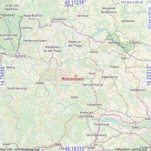
Röhrenbach GPS coordinates[2]
48° 39' 0" North, 15° 30' 0" East
| Map corner | latitude | longitude |
|---|---|---|
| Upper-left | 49.11239°, | 14.79688° |
| Center: | 48.65°, | 15.5° |
| Lower-right: | 48.18333°, | 16.20313° |
| Map W x H: | 103.3×103.3 km | = 64.2×64.2mi |
| max Lat: | 48.98333° ⇑2.7% North |
| Röhrenbach: | 48.65° |
| min Lat: | ⇓97.3% South 46.48841° |
| min Long | Röhrenbach | max Long |
| 9.57802° | 15.5° | 17.1° |
| W 65.5%⇐ | ⇒34.5% E |
Elevation
Elevation of Röhrenbach is 465 m = 1526 ft, and this is 40.5 m = 133 ft below average elevation for this country.
| Max E: |
2140 m = 7021 ft | 48% |
| Avg. | 505.5 m = 1658 ft | |
| Röhrenbach | 465 m = 1526 ft | |
Min E: |
118 m = 387 ft | 52% |
See also: Austria elevation on elevation.city.
Geographical zone
Röhrenbach is located in North temperate zone (between Tropic of Cancer and the Arctic Circle). Distance of this North polar circle is 1991.8 km =1237.6 mi to North.| Distance of | km | miles | from Röhrenbach |
|---|---|---|---|
| North Pole | 4597.7 | 2856.9 | to North |
| Arctic Circle | 1991.8 | 1237.6 | to North |
| Tropic Cancer | 2803.5 | 1742 | to South |
| Equator | 5409.4 | 3361.2 | to South |


Nearby cities:
15 places around Röhrenbach: (largest is in red/bold)
• Allentsteig
13.7 km =8.5 mi,  292°
292°
• Altenburg
6.8 km =4.2 mi,  92°
92°
• Brunn an der Wild
5.1 km =3.2 mi,  16°
16°
• Frauenhofen
9.7 km =6 mi,  74°
74°
• Gars am Kamp
13.2 km =8.2 mi,  120°
120°
• Gföhl
14.9 km =9.3 mi,  184°
184°
• Göpfritz an der Wild
11 km =6.8 mi,  319°
319°
• Horn
11.6 km =7.2 mi,  82°
82°
• Jaidhof
13 km =8.1 mi,  185°
185°
• Japons
16.6 km =10.3 mi, 17°
• Krumau am Kamp
7.8 km =4.8 mi,  208°
208°
• Pernegg
12.6 km =7.8 mi,  42°
42°
• Rastenfeld
15 km =9.3 mi,  235°
235°
• Sankt Leonhard am Hornerwald
6.1 km =3.8 mi,  156°
156°
• Wolfshoferamt
7.4 km =4.6 mi,  138°
138°
Sources, notices
• [Note1] Compared only with cities in Austria existing in our database
• [Src1] Map data: © OpenStreetMap contributors (CC-BY-SA)
• [Src2] Other city data from geonames.org with taken over terms of usage.
• [Src3] Geographical zone / Annual Mean Temperature by Robert A. Rohde @ Wikipedia
