Riverton geodata
Riverton (South Australia) is a populated place; located in Australia in Australia/Adelaide (GMT+10.5) time zone. With population of 994 people, there are 3829 cities with bigger population in this country. Compared to other cities in Australia, 60.9% of cities are located further ↑North; 77.6% of cities are located further →East and 86.4% of cities have lower elevation than Riverton. Note1


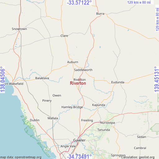
Riverton GPS coordinates[2]
34° 9' 18.252" South, 138° 44' 53.448" East
| Map corner | latitude | longitude |
|---|---|---|
| Upper-left | -33.57122°, | 138.04506° |
| Center: | -34.15507°, | 138.74818° |
| Lower-right: | -34.73491°, | 139.45131° |
| Map W x H: | 129.4×129.4 km | = 80.4×80.4mi |
| max Lat: | -10.58257° ⇑60.9% North |
| Riverton: | -34.15507° |
| min Lat: | ⇓39.1% South -43.31423° |
| min Long | Riverton | max Long |
| 113.53327° | 138.74818° | 153.61246° |
| W 22.4%⇐ | ⇒77.6% E |
Elevation
Elevation of Riverton is 275 m = 902 ft, and this is 153 m = 502 ft above average elevation for this country.
| Max E: |
1715 m = 5627 ft | 13.6% |
| Riverton | 275 m 902 ft | |
| Avg. | 122 m = 400 ft | |
Min E: |
-2 m = -7 ft | 86.4% |
See also: Australia elevation on elevation.city.
Geographical zone
Riverton is located in South temperate zone (between Tropic of Capricorn and the Antarctic Circle). Distance of this Southern Tropic circle is 1191.8 km =740.5 mi to North.| Distance of | km | miles | from Riverton |
|---|---|---|---|
| Equator | 3797.7 | 2359.8 | to North |
| Tropic Capricorn | 1191.8 | 740.5 | to North |
| Antarctic Circle | 3603.5 | 2239.1 | to South |
| South Pole | 6209.4 | 3858.3 | to South |


Nearby cities:
15 places around Riverton: (largest is in red/bold)
• Auburn
15.4 km =9.6 mi,  337°
337°
• Balaklava
31 km =19.3 mi,  271°
271°
• Clare
38 km =23.6 mi, 340°
• Eudunda
31 km =19.3 mi,  94°
94°
• Freeling
33.7 km =20.9 mi,  170°
170°
• Greenock
37.4 km =23.2 mi,  153°
153°
• Hamley Bridge
23.4 km =14.5 mi,  195°
195°
• Hewett
47 km =29.2 mi,  179°
179°
• Kapunda
25.6 km =15.9 mi,  142°
142°
• Mallala
38.3 km =23.8 mi,  214°
214°
• Nuriootpa
41.7 km =25.9 mi, 146°
• Roseworthy
42.1 km =26.2 mi, 179°
• Tanunda
45.3 km =28.1 mi, 154°
• Truro
44.8 km =27.8 mi,  128°
128°
• Wasleys
35.5 km =22.1 mi,  189°
189°
Sources, notices
• [Note1] Compared only with cities in Australia existing in our database
• [Src1] Map data: © OpenStreetMap contributors (CC-BY-SA)
• [Src2] Other city data from geonames.org with taken over terms of usage.
• [Src3] Geographical zone / Annual Mean Temperature by Robert A. Rohde @ Wikipedia
