Nullagine geodata
Nullagine (Western Australia) is a populated place; located in Australia in Australia/Perth (GMT+8) time zone. With population of 2,587 people, there are 2507 cities with bigger population in this country. Compared to other cities in Australia, 92.7% of cities are located further ↓South; 89.5% of cities are located further →East and 90.2% of cities have lower elevation than Nullagine. Note1


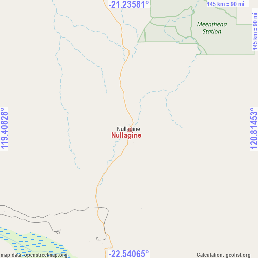
Nullagine GPS coordinates[2]
21° 53' 22.992" South, 120° 6' 41.04" East
| Map corner | latitude | longitude |
|---|---|---|
| Upper-left | -21.23581°, | 119.40828° |
| Center: | -21.88972°, | 120.1114° |
| Lower-right: | -22.54065°, | 120.81453° |
| Map W x H: | 145.1×145.1 km | = 90.2×90.2mi |
| max Lat: | -10.58257° ⇑7.3% North |
| Nullagine: | -21.88972° |
| min Lat: | ⇓92.7% South -43.31423° |
| min Long | Nullagine | max Long |
| 113.53327° | 120.1114° | 153.61246° |
| W 10.5%⇐ | ⇒89.5% E |
Elevation
Elevation of Nullagine is 383 m = 1257 ft, and this is 261 m = 856 ft above average elevation for this country.
| Max E: |
1715 m = 5627 ft | 9.8% |
| Nullagine | 383 m 1257 ft | |
| Avg. | 122 m = 400 ft | |
Min E: |
-2 m = -7 ft | 90.2% |
See also: Australia elevation on elevation.city.
Geographical zone
Nullagine is located in South Torrid zone (between Equator and Tropic of Capricorn). Distance of this Southern Tropic circle is 172 km =106.9 mi to South.| Distance of | km | miles | from Nullagine |
|---|---|---|---|
| Equator | 2433.9 | 1512.4 | to North |
| Tropic Capricorn | 172 | 106.9 | to South |
| Antarctic Circle | 4967.3 | 3086.5 | to South |
| South Pole | 7573.2 | 4705.8 | to South |


Nearby cities:
15 places around Nullagine: (largest is in red/bold)
• Bulgarra
361.1 km =224.4 mi,  290°
290°
• Eighty Mile Beach
333.5 km =207.2 mi,  27°
27°
• Karratha
361.6 km =224.7 mi, 290°
• Karratha Industrial Estate
358 km =222.5 mi, 290°
• Marble Bar
88.5 km =55 mi,  334°
334°
• Millars Well
364.3 km =226.4 mi, 290°
• Newman
167.6 km =104.1 mi,  193°
193°
• Paraburdoo
290.2 km =180.3 mi,  239°
239°
• Pegs Creek
362.9 km =225.5 mi, 290°
• Port Hedland
234.5 km =145.7 mi,  318°
318°
• Roebourne
331.3 km =205.9 mi, 292°
• South Hedland
227.5 km =141.4 mi, 316°
• Telfer
334.4 km =207.8 mi,  76°
76°
• Tom Price
254.7 km =158.3 mi,  249°
249°
• Wickham
336.4 km =209 mi, 293°
Sources, notices
• [Note1] Compared only with cities in Australia existing in our database
• [Src1] Map data: © OpenStreetMap contributors (CC-BY-SA)
• [Src2] Other city data from geonames.org with taken over terms of usage.
• [Src3] Geographical zone / Annual Mean Temperature by Robert A. Rohde @ Wikipedia
