Port Hedland geodata
Port Hedland (Western Australia) is a populated place; located in Australia in Australia/Perth (GMT+8) time zone. With population of 5,570 people, there are 1324 cities with bigger population in this country. Compared to other cities in Australia, 94.3% of cities are located further ↓South; 89.6% of cities are located further →East and 96.8% of cities have higher elevation than Port Hedland. Note1


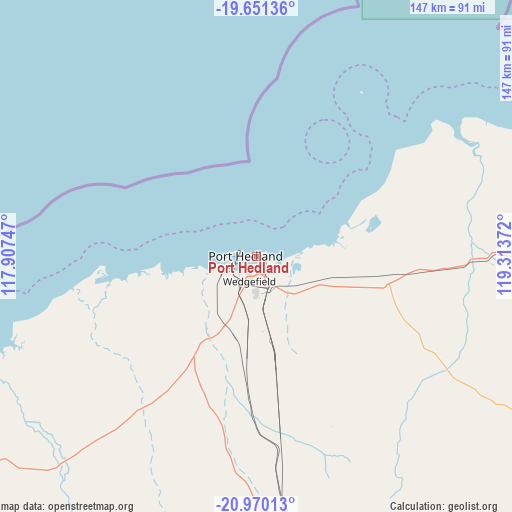
Port Hedland GPS coordinates[2]
20° 18' 43.74" South, 118° 36' 38.124" East
| Map corner | latitude | longitude |
|---|---|---|
| Upper-left | -19.65136°, | 117.90747° |
| Center: | -20.31215°, | 118.61059° |
| Lower-right: | -20.97013°, | 119.31372° |
| Map W x H: | 146.6×146.6 km | = 91.1×91.1mi |
| max Lat: | -10.58257° ⇑5.7% North |
| Port Hedland: | -20.31215° |
| min Lat: | ⇓94.3% South -43.31423° |
| min Long | Port Hedland | max Long |
| 113.53327° | 118.61059° | 153.61246° |
| W 10.4%⇐ | ⇒89.6% E |
Elevation
Elevation of Port Hedland is 5 m = 16 ft, and this is 117 m = 384 ft below average elevation for this country.
| Max E: |
1715 m = 5627 ft | 96.8% |
| Avg. | 122 m = 400 ft | |
| Port Hedland | 5 m = 16 ft | |
Min E: |
-2 m = -7 ft | 3.2% |
See also: Australia elevation on elevation.city.
Geographical zone
Port Hedland is located in South Torrid zone (between Equator and Tropic of Capricorn). Distance of this Southern Tropic circle is 347.4 km =215.9 mi to South.| Distance of | km | miles | from Port Hedland |
|---|---|---|---|
| Equator | 2258.5 | 1403.4 | to North |
| Tropic Capricorn | 347.4 | 215.9 | to South |
| Antarctic Circle | 5142.7 | 3195.5 | to South |
| South Pole | 7748.6 | 4814.8 | to South |


Nearby cities:
15 places around Port Hedland: (largest is in red/bold)
• Baynton
194.6 km =120.9 mi,  255°
255°
• Bulgarra
188.3 km =117 mi, 255°
• Dampier
201.5 km =125.2 mi, 258°
• Karratha
189.7 km =117.9 mi, 255°
• Karratha Industrial Estate
188.4 km =117.1 mi,  254°
254°
• Marble Bar
151.7 km =94.3 mi,  128°
128°
• Millars Well
192.7 km =119.7 mi, 255°
• Nickol
195.1 km =121.2 mi, 255°
• Nullagine
234.5 km =145.7 mi,  138°
138°
• Pannawonica
279.7 km =173.8 mi,  238°
238°
• Pegs Creek
191.1 km =118.7 mi, 255°
• Roebourne
160.8 km =99.9 mi, 251°
• South Hedland
10.5 km =6.5 mi,  185°
185°
• Tom Price
278 km =172.7 mi,  197°
197°
• Wickham
158.6 km =98.5 mi, 255°
Sources, notices
• [Note1] Compared only with cities in Australia existing in our database
• [Src1] Map data: © OpenStreetMap contributors (CC-BY-SA)
• [Src2] Other city data from geonames.org with taken over terms of usage.
• [Src3] Geographical zone / Annual Mean Temperature by Robert A. Rohde @ Wikipedia
