Telfer geodata
Telfer (Western Australia) is a section of populated place; located in Australia in Australia/Perth (GMT+8) time zone. With population of 1,396 people, there are 3377 cities with bigger population in this country. Compared to other cities in Australia, 93.1% of cities are located further ↓South; 88.7% of cities are located further →East and 88.2% of cities have lower elevation than Telfer. Note1


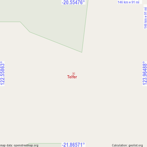
Telfer GPS coordinates[2]
21° 12' 42.084" South, 123° 15' 42.3" East
| Map corner | latitude | longitude |
|---|---|---|
| Upper-left | -20.55476°, | 122.55863° |
| Center: | -21.21169°, | 123.26175° |
| Lower-right: | -21.86571°, | 123.96488° |
| Map W x H: | 145.8×145.8 km | = 90.6×90.6mi |
| max Lat: | -10.58257° ⇑6.9% North |
| Telfer: | -21.21169° |
| min Lat: | ⇓93.1% South -43.31423° |
| min Long | Telfer | max Long |
| 113.53327° | 123.26175° | 153.61246° |
| W 11.3%⇐ | ⇒88.7% E |
Elevation
Elevation of Telfer is 319 m = 1047 ft, and this is 197 m = 646 ft above average elevation for this country.
| Max E: |
1715 m = 5627 ft | 11.8% |
| Telfer | 319 m 1047 ft | |
| Avg. | 122 m = 400 ft | |
Min E: |
-2 m = -7 ft | 88.2% |
See also: Australia elevation on elevation.city.
Geographical zone
Telfer is located in South Torrid zone (between Equator and Tropic of Capricorn). Distance of this Southern Tropic circle is 247.4 km =153.7 mi to South.| Distance of | km | miles | from Telfer |
|---|---|---|---|
| Equator | 2358.5 | 1465.5 | to North |
| Tropic Capricorn | 247.4 | 153.7 | to South |
| Antarctic Circle | 5042.7 | 3133.4 | to South |
| South Pole | 7648.5 | 4752.6 | to South |


Nearby cities:
13 places around Telfer: (largest is in red/bold)
• Bilingurr
382.8 km =237.9 mi,  343°
343°
• Broome
377.6 km =234.6 mi, 343°
• Cable Beach
377.8 km =234.8 mi, 343°
• Camballin
370.6 km =230.3 mi,  15°
15°
• Derby
436.3 km =271.1 mi,  5°
5°
• Djugun
378.1 km =234.9 mi, 343°
• Eighty Mile Beach
278.6 km =173.1 mi,  321°
321°
• Fitzroy Crossing
413 km =256.6 mi,  35°
35°
• Lagrange
320.8 km =199.3 mi,  331°
331°
• Marble Bar
364.7 km =226.6 mi,  270°
270°
• Nullagine
334.4 km =207.8 mi,  256°
256°
• Roebuck
347.3 km =215.8 mi,  346°
346°
• St George Ranges
307.8 km =191.3 mi, 36°
Sources, notices
• [Note1] Compared only with cities in Australia existing in our database
• [Src1] Map data: © OpenStreetMap contributors (CC-BY-SA)
• [Src2] Other city data from geonames.org with taken over terms of usage.
• [Src3] Geographical zone / Annual Mean Temperature by Robert A. Rohde @ Wikipedia
