Marble Bar geodata
Marble Bar (Western Australia) is a populated place; located in Australia in Australia/Perth (GMT+8) time zone. With population of 1,035 people, there are 3773 cities with bigger population in this country. Compared to other cities in Australia, 93.1% of cities are located further ↓South; 89.5% of cities are located further →East and 79.6% of cities have lower elevation than Marble Bar. Note1


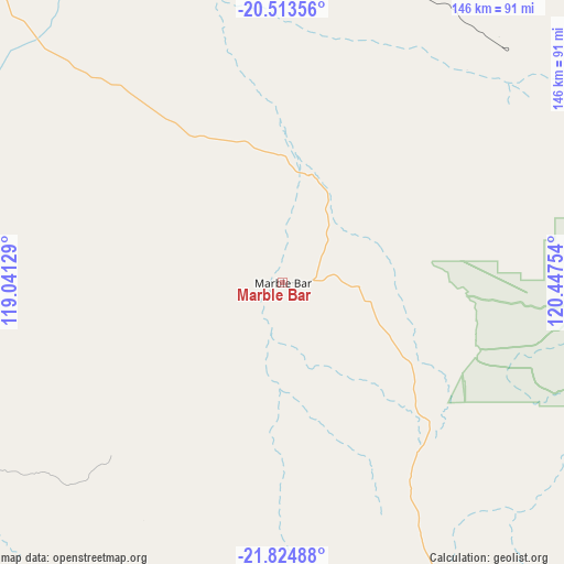
Marble Bar GPS coordinates[2]
21° 10' 14.412" South, 119° 44' 39.876" East
| Map corner | latitude | longitude |
|---|---|---|
| Upper-left | -20.51356°, | 119.04129° |
| Center: | -21.17067°, | 119.74441° |
| Lower-right: | -21.82488°, | 120.44754° |
| Map W x H: | 145.8×145.8 km | = 90.6×90.6mi |
| max Lat: | -10.58257° ⇑6.9% North |
| Marble Bar: | -21.17067° |
| min Lat: | ⇓93.1% South -43.31423° |
| min Long | Marble Bar | max Long |
| 113.53327° | 119.74441° | 153.61246° |
| W 10.5%⇐ | ⇒89.5% E |
Elevation
Elevation of Marble Bar is 177 m = 581 ft, and this is 55 m = 180 ft above average elevation for this country.
| Max E: |
1715 m = 5627 ft | 20.4% |
| Marble Bar | 177 m 581 ft | |
| Avg. | 122 m = 400 ft | |
Min E: |
-2 m = -7 ft | 79.6% |
See also: Australia elevation on elevation.city.
Geographical zone
Marble Bar is located in South Torrid zone (between Equator and Tropic of Capricorn). Distance of this Southern Tropic circle is 252 km =156.6 mi to South.| Distance of | km | miles | from Marble Bar |
|---|---|---|---|
| Equator | 2354 | 1462.7 | to North |
| Tropic Capricorn | 252 | 156.6 | to South |
| Antarctic Circle | 5047.2 | 3136.2 | to South |
| South Pole | 7653.1 | 4755.4 | to South |


Nearby cities:
15 places around Marble Bar: (largest is in red/bold)
• Baynton
309.1 km =192.1 mi,  278°
278°
• Bulgarra
303.9 km =188.8 mi, 279°
• Eighty Mile Beach
290 km =180.2 mi,  42°
42°
• Karratha
304.8 km =189.4 mi, 279°
• Karratha Industrial Estate
301.8 km =187.5 mi, 278°
• Millars Well
307.6 km =191.1 mi, 278°
• Newman
243 km =151 mi,  180°
180°
• Nickol
309.8 km =192.5 mi, 278°
• Nullagine
88.5 km =55 mi,  154°
154°
• Pegs Creek
306.1 km =190.2 mi, 279°
• Port Hedland
151.7 km =94.3 mi,  308°
308°
• Roebourne
273.3 km =169.8 mi, 279°
• South Hedland
146.1 km =90.8 mi, 305°
• Tom Price
263 km =163.4 mi,  229°
229°
• Wickham
276.3 km =171.7 mi, 281°
Sources, notices
• [Note1] Compared only with cities in Australia existing in our database
• [Src1] Map data: © OpenStreetMap contributors (CC-BY-SA)
• [Src2] Other city data from geonames.org with taken over terms of usage.
• [Src3] Geographical zone / Annual Mean Temperature by Robert A. Rohde @ Wikipedia
