Lameroo geodata
Lameroo (South Australia) is a populated place; located in Australia in Australia/Adelaide (GMT+10.5) time zone. With population of 819 people, there are 4111 cities with bigger population in this country. Compared to other cities in Australia, 75.7% of cities are located further ↑North; 75.9% of cities are located further →East and 69.8% of cities have lower elevation than Lameroo. Note1


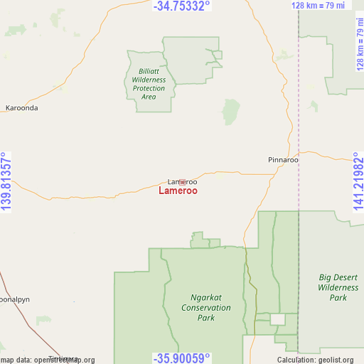
Lameroo GPS coordinates[2]
35° 19' 44.364" South, 140° 31' 0.084" East
| Map corner | latitude | longitude |
|---|---|---|
| Upper-left | -34.75332°, | 139.81357° |
| Center: | -35.32899°, | 140.51669° |
| Lower-right: | -35.90059°, | 141.21982° |
| Map W x H: | 127.6×127.6 km | = 79.3×79.3mi |
| max Lat: | -10.58257° ⇑75.7% North |
| Lameroo: | -35.32899° |
| min Lat: | ⇓24.3% South -43.31423° |
| min Long | Lameroo | max Long |
| 113.53327° | 140.51669° | 153.61246° |
| W 24.1%⇐ | ⇒75.9% E |
Elevation
Elevation of Lameroo is 102 m = 335 ft, and this is 20 m = 66 ft below average elevation for this country.
| Max E: |
1715 m = 5627 ft | 30.2% |
| Avg. | 122 m = 400 ft | |
| Lameroo | 102 m = 335 ft | |
Min E: |
-2 m = -7 ft | 69.8% |
See also: Australia elevation on elevation.city.
Geographical zone
Lameroo is located in South temperate zone (between Tropic of Capricorn and the Antarctic Circle). Distance of this Southern Tropic circle is 1322.3 km =821.6 mi to North.| Distance of | km | miles | from Lameroo |
|---|---|---|---|
| Equator | 3928.2 | 2440.9 | to North |
| Tropic Capricorn | 1322.3 | 821.6 | to North |
| Antarctic Circle | 3473 | 2158 | to South |
| South Pole | 6078.8 | 3777.2 | to South |


Nearby cities:
15 places around Lameroo: (largest is in red/bold)
• Barmera
119.5 km =74.3 mi,  357°
357°
• Berri
116.8 km =72.6 mi,  3°
3°
• Bordertown
111.2 km =69.1 mi,  168°
168°
• Glossop
117 km =72.7 mi, 1°
• Karoonda
62.3 km =38.7 mi,  294°
294°
• Keith
86.9 km =54 mi,  189°
189°
• Loveday
116.5 km =72.4 mi, 356°
• Loxton
97.8 km =60.8 mi, 2°
• Loxton North
101.9 km =63.3 mi,  5°
5°
• Meningie
113.7 km =70.6 mi,  249°
249°
• Murray Bridge
115.3 km =71.6 mi,  281°
281°
• Pinnaroo
36.6 km =22.7 mi,  78°
78°
• Riverglades
113.2 km =70.3 mi, 283°
• Tailem Bend
96.7 km =60.1 mi, 275°
• Tintinara
74.7 km =46.4 mi,  213°
213°
Sources, notices
• [Note1] Compared only with cities in Australia existing in our database
• [Src1] Map data: © OpenStreetMap contributors (CC-BY-SA)
• [Src2] Other city data from geonames.org with taken over terms of usage.
• [Src3] Geographical zone / Annual Mean Temperature by Robert A. Rohde @ Wikipedia
