Tintinara geodata
Tintinara (South Australia) is a populated place; located in Australia in Australia/Adelaide (GMT+10.5) time zone. With population of 501 people, there are 4877 cities with bigger population in this country. Compared to other cities in Australia, 78% of cities are located further ↑North; 76.1% of cities are located further →East and 70.9% of cities have higher elevation than Tintinara. Note1


Tintinara GPS coordinates[2]
35° 53' 13.56" South, 140° 3' 23.256" East
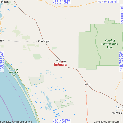
| Map corner | latitude | longitude |
|---|---|---|
| Upper-left | -35.3154°, | 139.35334° |
| Center: | -35.8871°, | 140.05646° |
| Lower-right: | -36.4547°, | 140.75959° |
| Map W x H: | 126.7×126.7 km | = 78.7×78.7mi |
| max Lat: | -10.58257° ⇑78% North |
| Tintinara: | -35.8871° |
| min Lat: | ⇓22% South -43.31423° |
| min Long | Tintinara | max Long |
| 113.53327° | 140.05646° | 153.61246° |
| W 23.9%⇐ | ⇒76.1% E |
Elevation
Elevation of Tintinara is 22 m = 72 ft, and this is 100 m = 328 ft below average elevation for this country.
| Max E: |
1715 m = 5627 ft | 70.9% |
| Avg. | 122 m = 400 ft | |
| Tintinara | 22 m = 72 ft | |
Min E: |
-2 m = -7 ft | 29.1% |
See also: Australia elevation on elevation.city.
Geographical zone
Tintinara is located in South temperate zone (between Tropic of Capricorn and the Antarctic Circle). Distance of this Southern Tropic circle is 1384.4 km =860.2 mi to North.| Distance of | km | miles | from Tintinara |
|---|---|---|---|
| Equator | 3990.3 | 2479.5 | to North |
| Tropic Capricorn | 1384.4 | 860.2 | to North |
| Antarctic Circle | 3410.9 | 2119.4 | to South |
| South Pole | 6016.8 | 3738.7 | to South |


Nearby cities:
15 places around Tintinara: (largest is in red/bold)
• Bordertown
79.5 km =49.4 mi,  126°
126°
• Goolwa North
120.7 km =75 mi,  291°
291°
• Goolwa South
122.4 km =76.1 mi, 289°
• Hindmarsh Island
115.2 km =71.6 mi, 291°
• Kaniva
119.7 km =74.4 mi,  117°
117°
• Karoonda
89.4 km =55.6 mi,  350°
350°
• Keith
35.6 km =22.1 mi, 131°
• Kingston South East
106.5 km =66.2 mi,  189°
189°
• Lameroo
74.7 km =46.4 mi,  33°
33°
• Meningie
68.4 km =42.5 mi, 289°
• Milang
111.6 km =69.3 mi,  298°
298°
• Murray Bridge
110.9 km =68.9 mi,  320°
320°
• Pinnaroo
104 km =64.6 mi,  48°
48°
• Riverglades
111.1 km =69 mi, 322°
• Tailem Bend
89.1 km =55.4 mi, 322°
Sources, notices
• [Note1] Compared only with cities in Australia existing in our database
• [Src1] Map data: © OpenStreetMap contributors (CC-BY-SA)
• [Src2] Other city data from geonames.org with taken over terms of usage.
• [Src3] Geographical zone / Annual Mean Temperature by Robert A. Rohde @ Wikipedia
