Derby geodata
Derby (Western Australia) is a populated place; located in Australia in Australia/Perth (GMT+8) time zone. With population of 4,110 people, there are 1750 cities with bigger population in this country. Compared to other cities in Australia, 96.7% of cities are located further ↓South; 88.7% of cities are located further →East and 83.5% of cities have higher elevation than Derby. Note1


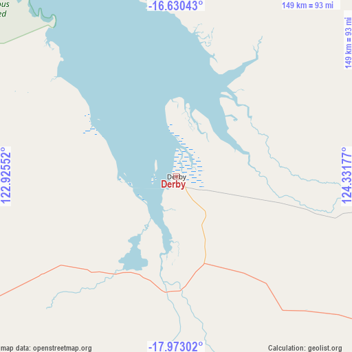
Derby GPS coordinates[2]
17° 18' 10.62" South, 123° 37' 43.104" East
| Map corner | latitude | longitude |
|---|---|---|
| Upper-left | -16.63043°, | 122.92552° |
| Center: | -17.30295°, | 123.62864° |
| Lower-right: | -17.97302°, | 124.33177° |
| Map W x H: | 149.3×149.3 km | = 92.8×92.8mi |
| max Lat: | -10.58257° ⇑3.3% North |
| Derby: | -17.30295° |
| min Lat: | ⇓96.7% South -43.31423° |
| min Long | Derby | max Long |
| 113.53327° | 123.62864° | 153.61246° |
| W 11.3%⇐ | ⇒88.7% E |
Elevation
Elevation of Derby is 13 m = 43 ft, and this is 109 m = 358 ft below average elevation for this country.
| Max E: |
1715 m = 5627 ft | 83.5% |
| Avg. | 122 m = 400 ft | |
| Derby | 13 m = 43 ft | |
Min E: |
-2 m = -7 ft | 16.5% |
See also: Australia elevation on elevation.city.
Geographical zone
Derby is located in South Torrid zone (between Equator and Tropic of Capricorn). Distance of this Southern Tropic circle is 682 km =423.8 mi to South.| Distance of | km | miles | from Derby |
|---|---|---|---|
| Equator | 1923.9 | 1195.5 | to North |
| Tropic Capricorn | 682 | 423.8 | to South |
| Antarctic Circle | 5477.3 | 3403.4 | to South |
| South Pole | 8083.2 | 5022.7 | to South |


Nearby cities:
13 places around Derby: (largest is in red/bold)
• Bilingurr
162.9 km =101.2 mi,  245°
245°
• Broome
164.1 km =102 mi,  243°
243°
• Cable Beach
166.9 km =103.7 mi, 244°
• Camballin
97.2 km =60.4 mi,  142°
142°
• Dampier Peninsula
91 km =56.5 mi,  296°
296°
• Djugun
165.1 km =102.6 mi, 244°
• Eighty Mile Beach
302.8 km =188.2 mi,  224°
224°
• Fitzroy Crossing
228 km =141.7 mi,  115°
115°
• King Leopold Ranges
197.9 km =123 mi,  83°
83°
• Lagrange
248.1 km =154.2 mi,  231°
231°
• Roebuck
153.6 km =95.4 mi, 231°
• St George Ranges
236.9 km =147.2 mi, 142°
• Telfer
436.3 km =271.1 mi,  185°
185°
Sources, notices
• [Note1] Compared only with cities in Australia existing in our database
• [Src1] Map data: © OpenStreetMap contributors (CC-BY-SA)
• [Src2] Other city data from geonames.org with taken over terms of usage.
• [Src3] Geographical zone / Annual Mean Temperature by Robert A. Rohde @ Wikipedia
