Fitzroy Crossing geodata
Fitzroy Crossing (Western Australia) is a populated place; located in Australia in Australia/Perth (GMT+8) time zone. With population of 1,783 people, there are 3063 cities with bigger population in this country. Compared to other cities in Australia, 96% of cities are located further ↓South; 88.6% of cities are located further →East and 72.9% of cities have lower elevation than Fitzroy Crossing. Note1


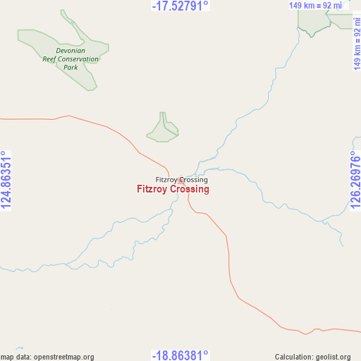
Fitzroy Crossing GPS coordinates[2]
18° 11' 49.704" South, 125° 33' 59.868" East
| Map corner | latitude | longitude |
|---|---|---|
| Upper-left | -17.52791°, | 124.86351° |
| Center: | -18.19714°, | 125.56663° |
| Lower-right: | -18.86381°, | 126.26976° |
| Map W x H: | 148.5×148.5 km | = 92.3×92.3mi |
| max Lat: | -10.58257° ⇑4% North |
| Fitzroy Crossing: | -18.19714° |
| min Lat: | ⇓96% South -43.31423° |
| min Long | Fitzroy Crossin | max Long |
| 113.53327° | 125.56663° | 153.61246° |
| W 11.4%⇐ | ⇒88.6% E |
Elevation
Elevation of Fitzroy Crossing is 117 m = 384 ft, and this is 5 m = 16 ft below average elevation for this country.
| Max E: |
1715 m = 5627 ft | 27.1% |
| Avg. | 122 m = 400 ft | |
| Fitzroy Crossing | 117 m = 384 ft | |
Min E: |
-2 m = -7 ft | 72.9% |
See also: Australia elevation on elevation.city.
Geographical zone
Fitzroy Crossing is located in South Torrid zone (between Equator and Tropic of Capricorn). Distance of this Southern Tropic circle is 582.6 km =362 mi to South.| Distance of | km | miles | from Fitzroy Crossing |
|---|---|---|---|
| Equator | 2023.3 | 1257.2 | to North |
| Tropic Capricorn | 582.6 | 362 | to South |
| Antarctic Circle | 5377.8 | 3341.6 | to South |
| South Pole | 7983.7 | 4960.8 | to South |


Nearby cities:
15 places around Fitzroy Crossing: (largest is in red/bold)
• Bilingurr
354.3 km =220.2 mi,  275°
275°
• Broome
352.7 km =219.2 mi,  274°
274°
• Cable Beach
355.5 km =220.9 mi, 274°
• Camballin
147.2 km =91.5 mi, 278°
• Dampier Peninsula
319 km =198.2 mi,  296°
296°
• Derby
228 km =141.7 mi, 295°
• Djugun
353.9 km =219.9 mi, 274°
• Halls Creek
221.8 km =137.8 mi,  90°
90°
• King Leopold Ranges
121.2 km =75.3 mi,  355°
355°
• Lagrange
402.5 km =250.1 mi,  262°
262°
• Lake Argyle
408.7 km =254 mi,  55°
55°
• Roebuck
323.8 km =201.2 mi, 270°
• St George Ranges
105.2 km =65.4 mi,  213°
213°
• Telfer
413 km =256.6 mi,  215°
215°
• Wyndham
406.1 km =252.3 mi,  42°
42°
Sources, notices
• [Note1] Compared only with cities in Australia existing in our database
• [Src1] Map data: © OpenStreetMap contributors (CC-BY-SA)
• [Src2] Other city data from geonames.org with taken over terms of usage.
• [Src3] Geographical zone / Annual Mean Temperature by Robert A. Rohde @ Wikipedia
