King Leopold Ranges geodata
King Leopold Ranges (Western Australia) is a section of populated place; located in Australia in Australia/Perth (GMT+8) time zone. With population of 766 people, there are 4213 cities with bigger population in this country. Compared to other cities in Australia, 96.8% of cities are located further ↓South; 88.7% of cities are located further →East and 92.5% of cities have lower elevation than King Leopold Ranges. Note1


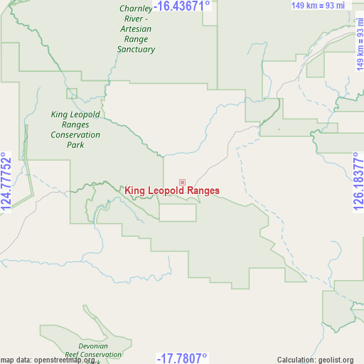
King Leopold Ranges GPS coordinates[2]
17° 6' 35.712" South, 125° 28' 50.304" East
| Map corner | latitude | longitude |
|---|---|---|
| Upper-left | -16.43671°, | 124.77752° |
| Center: | -17.10992°, | 125.48064° |
| Lower-right: | -17.7807°, | 126.18377° |
| Map W x H: | 149.4×149.4 km | = 92.8×92.8mi |
| max Lat: | -10.58257° ⇑3.2% North |
| King Leopold Ranges: | -17.10992° |
| min Lat: | ⇓96.8% South -43.31423° |
| min Long | King Leopold Ra | max Long |
| 113.53327° | 125.48064° | 153.61246° |
| W 11.3%⇐ | ⇒88.7% E |
Elevation
Elevation of King Leopold Ranges is 453 m = 1486 ft, and this is 331 m = 1086 ft above average elevation for this country.
| Max E: |
1715 m = 5627 ft | 7.5% |
| King Leopold Ranges | 453 m 1486 ft | |
| Avg. | 122 m = 400 ft | |
Min E: |
-2 m = -7 ft | 92.5% |
See also: Australia elevation on elevation.city.
Geographical zone
King Leopold Ranges is located in South Torrid zone (between Equator and Tropic of Capricorn). Distance of this Southern Tropic circle is 703.5 km =437.1 mi to South.| Distance of | km | miles | from King Leopold Ranges |
|---|---|---|---|
| Equator | 1902.4 | 1182.1 | to North |
| Tropic Capricorn | 703.5 | 437.1 | to South |
| Antarctic Circle | 5498.7 | 3416.7 | to South |
| South Pole | 8104.6 | 5036 | to South |


Nearby cities:
14 places around King Leopold Ranges: (largest is in red/bold)
• Bilingurr
356 km =221.2 mi,  255°
255°
• Broome
356.3 km =221.4 mi,  254°
254°
• Cable Beach
359.2 km =223.2 mi, 254°
• Camballin
168.5 km =104.7 mi,  234°
234°
• Dampier Peninsula
278.7 km =173.2 mi,  274°
274°
• Derby
197.9 km =123 mi, 263°
• Djugun
357.4 km =222.1 mi, 254°
• Fitzroy Crossing
121.2 km =75.3 mi,  175°
175°
• Halls Creek
262.7 km =163.2 mi,  118°
118°
• Kununurra
378 km =234.9 mi,  66°
66°
• Lake Argyle
364.1 km =226.2 mi, 72°
• Roebuck
337 km =209.4 mi, 249°
• St George Ranges
214.1 km =133 mi,  193°
193°
• Wyndham
334.9 km =208.1 mi,  57°
57°
Sources, notices
• [Note1] Compared only with cities in Australia existing in our database
• [Src1] Map data: © OpenStreetMap contributors (CC-BY-SA)
• [Src2] Other city data from geonames.org with taken over terms of usage.
• [Src3] Geographical zone / Annual Mean Temperature by Robert A. Rohde @ Wikipedia
