Borroloola geodata
Borroloola (Northern Territory) is a populated place; located in Australia in Australia/Darwin (GMT+9.5) time zone. With population of 956 people, there are 3890 cities with bigger population in this country. Compared to other cities in Australia, 97.9% of cities are located further ↓South; 86.1% of cities are located further →East and 77.5% of cities have higher elevation than Borroloola. Note1


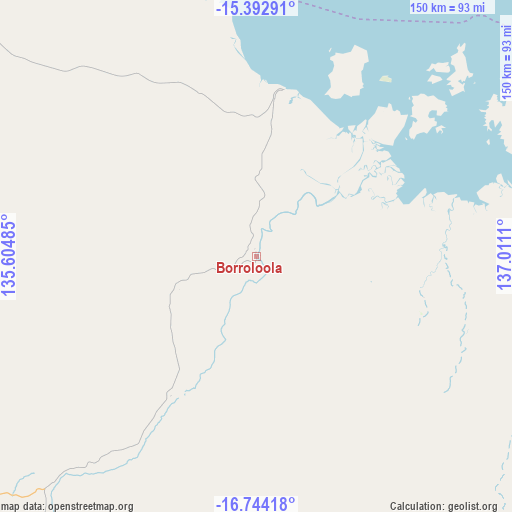
Borroloola GPS coordinates[2]
16° 4' 10.884" South, 136° 18' 28.692" East
| Map corner | latitude | longitude |
|---|---|---|
| Upper-left | -15.39291°, | 135.60485° |
| Center: | -16.06969°, | 136.30797° |
| Lower-right: | -16.74418°, | 137.0111° |
| Map W x H: | 150.2×150.3 km | = 93.3×93.4mi |
| max Lat: | -10.58257° ⇑2.1% North |
| Borroloola: | -16.06969° |
| min Lat: | ⇓97.9% South -43.31423° |
| min Long | Borroloola | max Long |
| 113.53327° | 136.30797° | 153.61246° |
| W 13.9%⇐ | ⇒86.1% E |
Elevation
Elevation of Borroloola is 17 m = 56 ft, and this is 105 m = 344 ft below average elevation for this country.
| Max E: |
1715 m = 5627 ft | 77.5% |
| Avg. | 122 m = 400 ft | |
| Borroloola | 17 m = 56 ft | |
Min E: |
-2 m = -7 ft | 22.5% |
See also: Australia elevation on elevation.city.
Geographical zone
Borroloola is located in South Torrid zone (between Equator and Tropic of Capricorn). Distance of this Southern Tropic circle is 819.1 km =509 mi to South.| Distance of | km | miles | from Borroloola |
|---|---|---|---|
| Equator | 1786.8 | 1110.3 | to North |
| Tropic Capricorn | 819.1 | 509 | to South |
| Antarctic Circle | 5614.4 | 3488.6 | to South |
| South Pole | 8220.3 | 5107.9 | to South |


Nearby cities:
11 places around Borroloola: (largest is in red/bold)
• Alyangula
246.6 km =153.2 mi,  2°
2°
• Beswick
381.4 km =237 mi,  296°
296°
• Doomadgee
339.3 km =210.8 mi,  127°
127°
• Gapuwiyak
400.2 km =248.7 mi,  352°
352°
• Mataranka
370.2 km =230 mi,  290°
290°
• Miniyeri
256.4 km =159.3 mi, 291°
• Ngukurr
225.2 km =139.9 mi,  311°
311°
• Nhulunbuy
435.3 km =270.5 mi,  6°
6°
• Ramingining
441.3 km =274.2 mi,  340°
340°
• Wellesley Islands
335.9 km =208.7 mi,  100°
100°
• Yirrkala
428.8 km =266.4 mi, 8°
Sources, notices
• [Note1] Compared only with cities in Australia existing in our database
• [Src1] Map data: © OpenStreetMap contributors (CC-BY-SA)
• [Src2] Other city data from geonames.org with taken over terms of usage.
• [Src3] Geographical zone / Annual Mean Temperature by Robert A. Rohde @ Wikipedia
