Miniyeri geodata
Miniyeri (Northern Territory) is a section of populated place; located in Australia in Australia/Darwin (GMT+9.5) time zone. With population of 660 people, there are 4408 cities with bigger population in this country. Compared to other cities in Australia, 98% of cities are located further ↓South; 86.4% of cities are located further →East and 69.7% of cities have lower elevation than Miniyeri. Note1


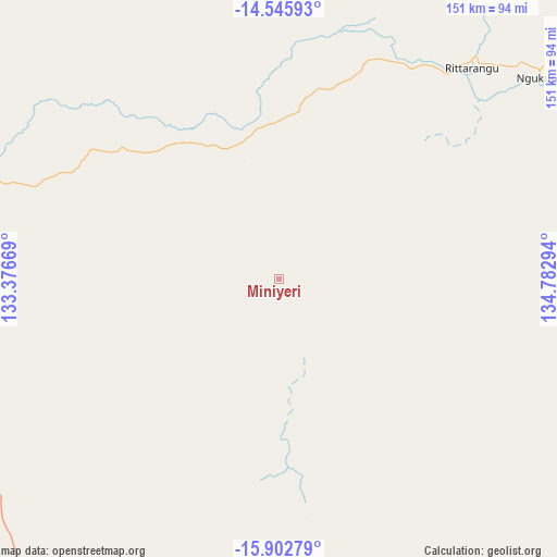
Miniyeri GPS coordinates[2]
15° 13' 31.62" South, 134° 4' 47.316" East
| Map corner | latitude | longitude |
|---|---|---|
| Upper-left | -14.54593°, | 133.37669° |
| Center: | -15.22545°, | 134.07981° |
| Lower-right: | -15.90279°, | 134.78294° |
| Map W x H: | 150.9×150.9 km | = 93.8×93.8mi |
| max Lat: | -10.58257° ⇑2% North |
| Miniyeri: | -15.22545° |
| min Lat: | ⇓98% South -43.31423° |
| min Long | Miniyeri | max Long |
| 113.53327° | 134.07981° | 153.61246° |
| W 13.6%⇐ | ⇒86.4% E |
Elevation
Elevation of Miniyeri is 101 m = 331 ft, and this is 21 m = 69 ft below average elevation for this country.
| Max E: |
1715 m = 5627 ft | 30.3% |
| Avg. | 122 m = 400 ft | |
| Miniyeri | 101 m = 331 ft | |
Min E: |
-2 m = -7 ft | 69.7% |
See also: Australia elevation on elevation.city.
Geographical zone
Miniyeri is located in South Torrid zone (between Equator and Tropic of Capricorn). Distance of this Southern Tropic circle is 913 km =567.3 mi to South.| Distance of | km | miles | from Miniyeri |
|---|---|---|---|
| Equator | 1692.9 | 1051.9 | to North |
| Tropic Capricorn | 913 | 567.3 | to South |
| Antarctic Circle | 5708.3 | 3547 | to South |
| South Pole | 8314.2 | 5166.2 | to South |


Nearby cities:
15 places around Miniyeri: (largest is in red/bold)
• Alyangula
294.5 km =183 mi,  58°
58°
• Beswick
127.5 km =79.2 mi,  305°
305°
• Borroloola
256.4 km =159.3 mi,  111°
111°
• Cossack
221.9 km =137.9 mi,  292°
292°
• Douglas-Daly
333.7 km =207.4 mi,  298°
298°
• Jabiru
314.2 km =195.2 mi,  334°
334°
• Kakadu
314.1 km =195.2 mi, 326°
• Katherine
212.7 km =132.2 mi, 293°
• Katherine East
210.5 km =130.8 mi, 293°
• Katherine South
213.1 km =132.4 mi, 293°
• Lansdowne
202.2 km =125.6 mi, 295°
• Mataranka
114.1 km =70.9 mi, 287°
• Ngukurr
89 km =55.3 mi,  51°
51°
• Tindal
198.4 km =123.3 mi, 292°
• West Arnhem
332.5 km =206.6 mi,  359°
359°
Sources, notices
• [Note1] Compared only with cities in Australia existing in our database
• [Src1] Map data: © OpenStreetMap contributors (CC-BY-SA)
• [Src2] Other city data from geonames.org with taken over terms of usage.
• [Src3] Geographical zone / Annual Mean Temperature by Robert A. Rohde @ Wikipedia
