Westcourt geodata
Westcourt (Queensland) is a populated place; located in Australia in Australia/Brisbane (GMT+10) time zone. With population of 3,177 people, there are 2143 cities with bigger population in this country. Compared to other cities in Australia, 86% of cities are located further ↓South; 57.4% of cities are located further ←West and 87.2% of cities have lower elevation than Westcourt. Note1


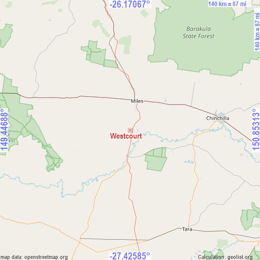
Westcourt GPS coordinates[2]
26° 48' 0" South, 150° 9' 0" East
| Map corner | latitude | longitude |
|---|---|---|
| Upper-left | -26.17067°, | 149.44688° |
| Center: | -26.8°, | 150.15° |
| Lower-right: | -27.42585°, | 150.85313° |
| Map W x H: | 139.6×139.6 km | = 86.7×86.7mi |
| max Lat: | -10.58257° ⇑14% North |
| Westcourt: | -26.8° |
| min Lat: | ⇓86% South -43.31423° |
| min Long | Westcourt | max Long |
| 113.53327° | 150.15° | 153.61246° |
| W 57.4%⇐ | ⇒42.6% E |
Elevation
Elevation of Westcourt is 290 m = 951 ft, and this is 168 m = 551 ft above average elevation for this country.
| Max E: |
1715 m = 5627 ft | 12.8% |
| Westcourt | 290 m 951 ft | |
| Avg. | 122 m = 400 ft | |
Min E: |
-2 m = -7 ft | 87.2% |
See also: Australia elevation on elevation.city.
Geographical zone
Westcourt is located in South temperate zone (between Tropic of Capricorn and the Antarctic Circle). Distance of this Southern Tropic circle is 374 km =232.4 mi to North.| Distance of | km | miles | from Westcourt |
|---|---|---|---|
| Equator | 2979.9 | 1851.6 | to North |
| Tropic Capricorn | 374 | 232.4 | to North |
| Antarctic Circle | 4421.3 | 2747.3 | to South |
| South Pole | 7027.2 | 4366.5 | to South |


Nearby cities:
15 places around Westcourt: (largest is in red/bold)
• Chinchilla
48.1 km =29.9 mi,  81°
81°
• Dalby
118.1 km =73.4 mi,  111°
111°
• Goombungee
177.7 km =110.4 mi, 108°
• Jandowae
95.5 km =59.3 mi,  88°
88°
• Kingaroy
170.1 km =105.7 mi, 80°
• Miles
16.2 km =10.1 mi,  13°
13°
• Millmerran
163.2 km =101.4 mi,  137°
137°
• Mundubbera
176.7 km =109.8 mi,  40°
40°
• Oakey
170.6 km =106 mi, 114°
• Pittsworth
178.6 km =111 mi,  124°
124°
• Roma
137.8 km =85.6 mi,  280°
280°
• Taabinga
168.9 km =104.9 mi, 81°
• Tara
61 km =37.9 mi,  150°
150°
• Taroom
133.7 km =83.1 mi,  344°
344°
• Wandoan
77.6 km =48.2 mi,  345°
345°
Sources, notices
• [Note1] Compared only with cities in Australia existing in our database
• [Src1] Map data: © OpenStreetMap contributors (CC-BY-SA)
• [Src2] Other city data from geonames.org with taken over terms of usage.
• [Src3] Geographical zone / Annual Mean Temperature by Robert A. Rohde @ Wikipedia
