Baradine geodata
Baradine (New South Wales) is a populated place; located in Australia in Australia/Sydney (GMT+11) time zone. With population of 767 people, there are 4211 cities with bigger population in this country. Compared to other cities in Australia, 70.9% of cities are located further ↓South; 53.4% of cities are located further ←West and 87.6% of cities have lower elevation than Baradine. Note1


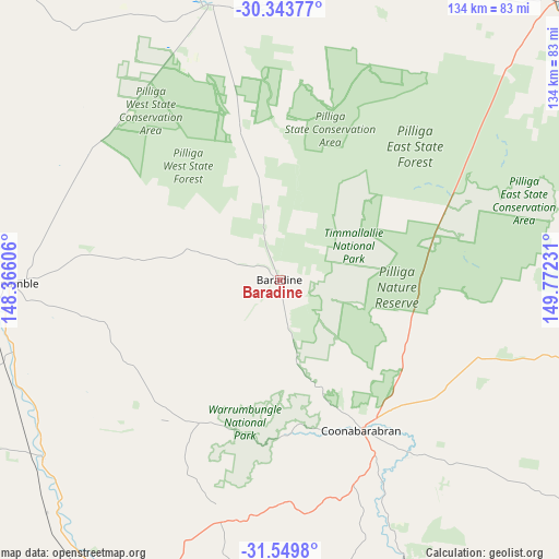
Baradine GPS coordinates[2]
30° 56' 55.284" South, 149° 4' 9.048" East
| Map corner | latitude | longitude |
|---|---|---|
| Upper-left | -30.34377°, | 148.36606° |
| Center: | -30.94869°, | 149.06918° |
| Lower-right: | -31.5498°, | 149.77231° |
| Map W x H: | 134.1×134.1 km | = 83.3×83.3mi |
| max Lat: | -10.58257° ⇑29.1% North |
| Baradine: | -30.94869° |
| min Lat: | ⇓70.9% South -43.31423° |
| min Long | Baradine | max Long |
| 113.53327° | 149.06918° | 153.61246° |
| W 53.4%⇐ | ⇒46.6% E |
Elevation
Elevation of Baradine is 303 m = 994 ft, and this is 181 m = 594 ft above average elevation for this country.
| Max E: |
1715 m = 5627 ft | 12.4% |
| Baradine | 303 m 994 ft | |
| Avg. | 122 m = 400 ft | |
Min E: |
-2 m = -7 ft | 87.6% |
See also: Australia elevation on elevation.city.
Geographical zone
Baradine is located in South temperate zone (between Tropic of Capricorn and the Antarctic Circle). Distance of this Southern Tropic circle is 835.3 km =519 mi to North.| Distance of | km | miles | from Baradine |
|---|---|---|---|
| Equator | 3441.2 | 2138.3 | to North |
| Tropic Capricorn | 835.3 | 519 | to North |
| Antarctic Circle | 3960 | 2460.6 | to South |
| South Pole | 6565.9 | 4079.9 | to South |


Nearby cities:
15 places around Baradine: (largest is in red/bold)
• Binnaway
73.3 km =45.5 mi,  156°
156°
• Blair Athol
113 km =70.2 mi,  72°
72°
• Boggabri
96.5 km =60 mi, 74°
• Coolah
115.4 km =71.7 mi,  147°
147°
• Coonabarabran
41.6 km =25.8 mi, 151°
• Coonamble
64.9 km =40.3 mi,  269°
269°
• Curlewis
115.7 km =71.9 mi,  99°
99°
• Dunedoo
122.5 km =76.1 mi,  165°
165°
• Gilgandra
93.2 km =57.9 mi,  204°
204°
• Gulargambone
71.2 km =44.2 mi,  232°
232°
• Gunnedah
113.4 km =70.5 mi,  91°
91°
• Mendooran
97.3 km =60.5 mi,  177°
177°
• Narrabri
97.3 km =60.5 mi,  44°
44°
• Walgett
137.5 km =85.4 mi,  318°
318°
• Wee Waa
87.8 km =54.6 mi,  23°
23°
Sources, notices
• [Note1] Compared only with cities in Australia existing in our database
• [Src1] Map data: © OpenStreetMap contributors (CC-BY-SA)
• [Src2] Other city data from geonames.org with taken over terms of usage.
• [Src3] Geographical zone / Annual Mean Temperature by Robert A. Rohde @ Wikipedia
