Pannawonica geodata
Pannawonica (Western Australia) is a populated place; located in Australia in Australia/Perth (GMT+8) time zone. With population of 951 people, there are 3894 cities with bigger population in this country. Compared to other cities in Australia, 92.8% of cities are located further ↓South; 91.1% of cities are located further →East and 81.7% of cities have lower elevation than Pannawonica. Note1


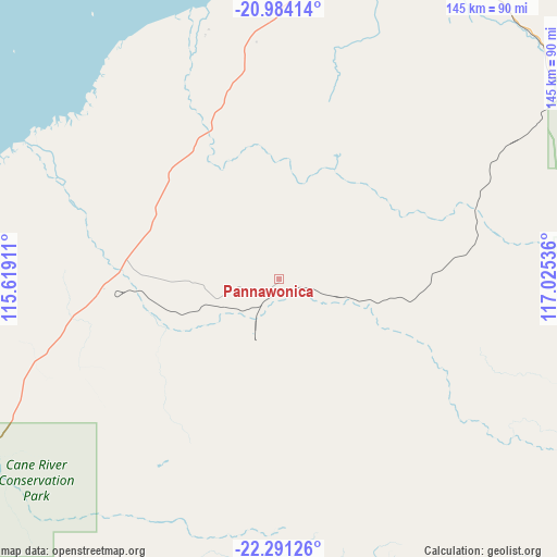
Pannawonica GPS coordinates[2]
21° 38' 21.048" South, 116° 19' 20.028" East
| Map corner | latitude | longitude |
|---|---|---|
| Upper-left | -20.98414°, | 115.61911° |
| Center: | -21.63918°, | 116.32223° |
| Lower-right: | -22.29126°, | 117.02536° |
| Map W x H: | 145.3×145.3 km | = 90.3×90.3mi |
| max Lat: | -10.58257° ⇑7.2% North |
| Pannawonica: | -21.63918° |
| min Lat: | ⇓92.8% South -43.31423° |
| min Long | Pannawonica | max Long |
| 113.53327° | 116.32223° | 153.61246° |
| W 8.9%⇐ | ⇒91.1% E |
Elevation
Elevation of Pannawonica is 201 m = 659 ft, and this is 79 m = 259 ft above average elevation for this country.
| Max E: |
1715 m = 5627 ft | 18.3% |
| Pannawonica | 201 m 659 ft | |
| Avg. | 122 m = 400 ft | |
Min E: |
-2 m = -7 ft | 81.7% |
See also: Australia elevation on elevation.city.
Geographical zone
Pannawonica is located in South Torrid zone (between Equator and Tropic of Capricorn). Distance of this Southern Tropic circle is 199.9 km =124.2 mi to South.| Distance of | km | miles | from Pannawonica |
|---|---|---|---|
| Equator | 2406.1 | 1495.1 | to North |
| Tropic Capricorn | 199.9 | 124.2 | to South |
| Antarctic Circle | 4995.1 | 3103.8 | to South |
| South Pole | 7601 | 4723 | to South |


Nearby cities:
15 places around Pannawonica: (largest is in red/bold)
• Baynton
110.5 km =68.7 mi,  26°
26°
• Bulgarra
115.7 km =71.9 mi, 28°
• Dampier
115.9 km =72 mi,  20°
20°
• Exmouth
229.6 km =142.7 mi,  261°
261°
• Karratha
114 km =70.8 mi, 28°
• Karratha Industrial Estate
111.9 km =69.5 mi, 30°
• Millars Well
112.2 km =69.7 mi, 27°
• Nickol
110.8 km =68.8 mi, 26°
• North West Cape
238.9 km =148.4 mi, 262°
• Onslow
125.1 km =77.7 mi,  270°
270°
• Paraburdoo
222.4 km =138.2 mi,  141°
141°
• Pegs Creek
113.3 km =70.4 mi, 27°
• Roebourne
128.8 km =80 mi,  41°
41°
• Tom Price
191.6 km =119.1 mi,  127°
127°
• Wickham
136.6 km =84.9 mi, 38°
Sources, notices
• [Note1] Compared only with cities in Australia existing in our database
• [Src1] Map data: © OpenStreetMap contributors (CC-BY-SA)
• [Src2] Other city data from geonames.org with taken over terms of usage.
• [Src3] Geographical zone / Annual Mean Temperature by Robert A. Rohde @ Wikipedia
