Gilgai geodata
Gilgai (New South Wales) is a populated place; located in Australia in Australia/Sydney (GMT+11) time zone. With population of 689 people, there are 4340 cities with bigger population in this country. Compared to other cities in Australia, 72.4% of cities are located further ↓South; 70.6% of cities are located further ←West and 98.7% of cities have lower elevation than Gilgai. Note1


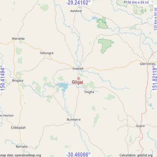
Gilgai GPS coordinates[2]
29° 51' 9.72" South, 151° 7' 5.016" East
| Map corner | latitude | longitude |
|---|---|---|
| Upper-left | -29.24102°, | 150.41494° |
| Center: | -29.8527°, | 151.11806° |
| Lower-right: | -30.46066°, | 151.82119° |
| Map W x H: | 135.6×135.6 km | = 84.3×84.3mi |
| max Lat: | -10.58257° ⇑27.6% North |
| Gilgai: | -29.8527° |
| min Lat: | ⇓72.4% South -43.31423° |
| min Long | Gilgai | max Long |
| 113.53327° | 151.11806° | 153.61246° |
| W 70.6%⇐ | ⇒29.4% E |
Elevation
Elevation of Gilgai is 741 m = 2431 ft, and this is 619 m = 2031 ft above average elevation for this country.
| Max E: |
1715 m = 5627 ft | 1.3% |
| Gilgai | 741 m 2431 ft | |
| Avg. | 122 m = 400 ft | |
Min E: |
-2 m = -7 ft | 98.7% |
See also: Australia elevation on elevation.city.
Geographical zone
Gilgai is located in South temperate zone (between Tropic of Capricorn and the Antarctic Circle). Distance of this Southern Tropic circle is 713.4 km =443.3 mi to North.| Distance of | km | miles | from Gilgai |
|---|---|---|---|
| Equator | 3319.3 | 2062.5 | to North |
| Tropic Capricorn | 713.4 | 443.3 | to North |
| Antarctic Circle | 4081.9 | 2536.4 | to South |
| South Pole | 6687.8 | 4155.6 | to South |


Nearby cities:
15 places around Gilgai: (largest is in red/bold)
• Armidale
89.3 km =55.5 mi,  143°
143°
• Ashford
59.1 km =36.7 mi,  357°
357°
• Barraba
76.9 km =47.8 mi,  219°
219°
• Bingara
52.7 km =32.7 mi,  267°
267°
• Bundarra
35.7 km =22.2 mi,  186°
186°
• Delungra
35.5 km =22.1 mi,  308°
308°
• Emmaville
64.9 km =40.3 mi,  45°
45°
• Glen Innes
61.3 km =38.1 mi,  77°
77°
• Guyra
66.6 km =41.4 mi,  127°
127°
• Inverell
8.8 km =5.5 mi, 355°
• Invergowrie
82.3 km =51.1 mi,  152°
152°
• Mitchell
98.2 km =61 mi, 78°
• Tingha
14.6 km =9.1 mi, 141°
• Uralla
95.1 km =59.1 mi,  157°
157°
• Warialda
62.7 km =39 mi,  303°
303°
Sources, notices
• [Note1] Compared only with cities in Australia existing in our database
• [Src1] Map data: © OpenStreetMap contributors (CC-BY-SA)
• [Src2] Other city data from geonames.org with taken over terms of usage.
• [Src3] Geographical zone / Annual Mean Temperature by Robert A. Rohde @ Wikipedia
