Lake Argyle geodata
Lake Argyle (Western Australia) is a populated place; located in Australia in Australia/Perth (GMT+8) time zone. With population of 673 people, there are 4375 cities with bigger population in this country. Compared to other cities in Australia, 97.8% of cities are located further ↓South; 88.5% of cities are located further →East and 67.3% of cities have lower elevation than Lake Argyle. Note1


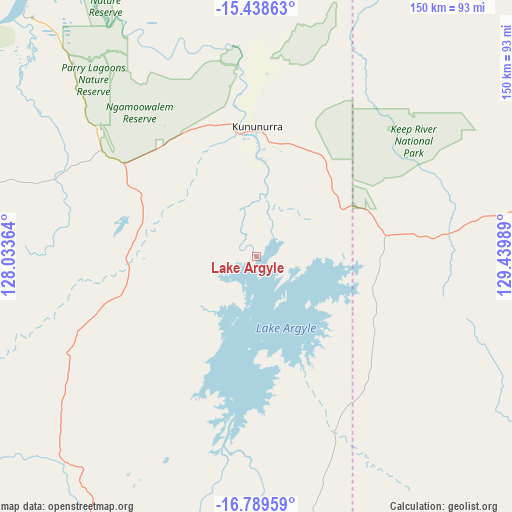
Lake Argyle GPS coordinates[2]
16° 6' 54.936" South, 128° 44' 12.336" East
| Map corner | latitude | longitude |
|---|---|---|
| Upper-left | -15.43863°, | 128.03364° |
| Center: | -16.11526°, | 128.73676° |
| Lower-right: | -16.78959°, | 129.43989° |
| Map W x H: | 150.2×150.2 km | = 93.3×93.3mi |
| max Lat: | -10.58257° ⇑2.2% North |
| Lake Argyle: | -16.11526° |
| min Lat: | ⇓97.8% South -43.31423° |
| min Long | Lake Argyle | max Long |
| 113.53327° | 128.73676° | 153.61246° |
| W 11.5%⇐ | ⇒88.5% E |
Elevation
Elevation of Lake Argyle is 90 m = 295 ft, and this is 32 m = 105 ft below average elevation for this country.
| Max E: |
1715 m = 5627 ft | 32.7% |
| Avg. | 122 m = 400 ft | |
| Lake Argyle | 90 m = 295 ft | |
Min E: |
-2 m = -7 ft | 67.3% |
See also: Australia elevation on elevation.city.
Geographical zone
Lake Argyle is located in South Torrid zone (between Equator and Tropic of Capricorn). Distance of this Southern Tropic circle is 814.1 km =505.9 mi to South.| Distance of | km | miles | from Lake Argyle |
|---|---|---|---|
| Equator | 1791.8 | 1113.4 | to North |
| Tropic Capricorn | 814.1 | 505.9 | to South |
| Antarctic Circle | 5609.3 | 3485.5 | to South |
| South Pole | 8215.2 | 5104.7 | to South |


Nearby cities:
15 places around Lake Argyle: (largest is in red/bold)
• Batchelor
420.8 km =261.5 mi,  35°
35°
• Cossack
412.3 km =256.2 mi,  63°
63°
• Darwin River
438.3 km =272.3 mi,  33°
33°
• Douglas-Daly
381 km =236.7 mi,  47°
47°
• Fitzroy Crossing
408.7 km =254 mi,  235°
235°
• Halls Creek
260.7 km =162 mi,  205°
205°
• Katherine
420.4 km =261.2 mi, 64°
• Katherine East
422.5 km =262.5 mi, 64°
• Katherine South
419.8 km =260.9 mi, 64°
• King Leopold Ranges
364.1 km =226.2 mi,  252°
252°
• Kununurra
37.5 km =23.3 mi,  0°
0°
• Lajamanu
319 km =198.2 mi,  140°
140°
• Tindal
428.5 km =266.3 mi,  65°
65°
• Wadeye
225.1 km =139.9 mi,  21°
21°
• Wyndham
95.8 km =59.5 mi,  316°
316°
Sources, notices
• [Note1] Compared only with cities in Australia existing in our database
• [Src1] Map data: © OpenStreetMap contributors (CC-BY-SA)
• [Src2] Other city data from geonames.org with taken over terms of usage.
• [Src3] Geographical zone / Annual Mean Temperature by Robert A. Rohde @ Wikipedia
