Qabaqçöl geodata
Qabaqçöl (Balakǝn) is a populated place; located in Azerbaijan in Asia/Baku (GMT+4) time zone. With population of 1,293 people, there are 164 cities with bigger population in this country. Compared to other cities in Azerbaijan, 100% of cities are located further ↓South; 77.8% of cities are located further →East and 56.8% of cities have lower elevation than Qabaqçöl. Note1


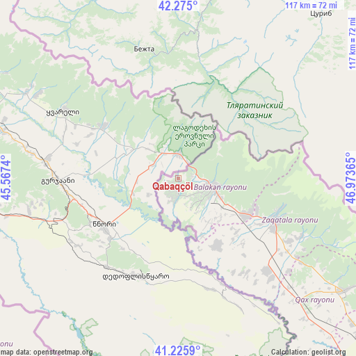
Qabaqçöl GPS coordinates[2]
41° 45' 9.324" North, 46° 16' 13.872" East
| Map corner | latitude | longitude |
|---|---|---|
| Upper-left | 42.275°, | 45.5674° |
| Center: | 41.75259°, | 46.27052° |
| Lower-right: | 41.2259°, | 46.97365° |
| Map W x H: | 116.6×116.6 km | = 72.5×72.5mi |
| max Lat: | 41.75259° ⇑0% North |
| Qabaqçöl: | 41.75259° |
| min Lat: | ⇓100% South 38.45598° |
| min Long | Qabaqçöl | max Long |
| 44.84846° | 46.27052° | 50.84003° |
| W 22.2%⇐ | ⇒77.8% E |
Elevation
Elevation of Qabaqçöl is 267 m = 876 ft, and this is 116 m = 381 ft below average elevation for this country.
| Max E: |
2211 m = 7254 ft | 43.2% |
| Avg. | 383 m = 1257 ft | |
| Qabaqçöl | 267 m = 876 ft | |
Min E: |
-26 m = -85 ft | 56.8% |
See also: Azerbaijan elevation on elevation.city.
Geographical zone
Qabaqçöl is located in North temperate zone (between Tropic of Cancer and the Arctic Circle). Distance of this Northern Tropic circle is 2036.5 km =1265.4 mi to South.| Distance of | km | miles | from Qabaqçöl |
|---|---|---|---|
| North Pole | 5364.6 | 3333.4 | to North |
| Arctic Circle | 2758.7 | 1714.2 | to North |
| Tropic Cancer | 2036.5 | 1265.4 | to South |
| Equator | 4642.5 | 2884.7 | to South |


Nearby cities:
15 places around Qabaqçöl: (largest is in red/bold)
• Aliabad
42.6 km =26.5 mi,  134°
134°
• Baş Göynük
84.7 km =52.6 mi,  124°
124°
• Belokany
11.5 km =7.1 mi,  104°
104°
• Faldarlı
37.6 km =23.4 mi,  147°
147°
• Mamrux
47.4 km =29.5 mi, 119°
• Qandax
38.2 km =23.7 mi,  143°
143°
• Qaraxanlı
94.1 km =58.5 mi,  213°
213°
• Qax
65.6 km =40.8 mi, 124°
• Qax İngiloy
66.5 km =41.3 mi, 123°
• Qaxbaş
67.8 km =42.1 mi, 121°
• Qırmızı Samux
90.8 km =56.4 mi,  174°
174°
• Saloğlu
93 km =57.8 mi,  235°
235°
• Sheki
97.5 km =60.6 mi, 129°
• Zaqatala
33.9 km =21.1 mi,  113°
113°
• Çinarlı
62.2 km =38.6 mi, 120°
Sources, notices
• [Note1] Compared only with cities in Azerbaijan existing in our database
• [Src1] Map data: © OpenStreetMap contributors (CC-BY-SA)
• [Src2] Other city data from geonames.org with taken over terms of usage.
• [Src3] Geographical zone / Annual Mean Temperature by Robert A. Rohde @ Wikipedia
