Belokany geodata
Belokany (Balakǝn) is a seat of a first-order administrative division; located in Azerbaijan in Asia/Baku (GMT+4) time zone. With population of 9,182 people, there are 77 cities with bigger population in this country. Compared to other cities in Azerbaijan, 99.5% of cities are located further ↓South; 75.1% of cities are located further →East and 61.6% of cities have lower elevation than Belokany. Note1


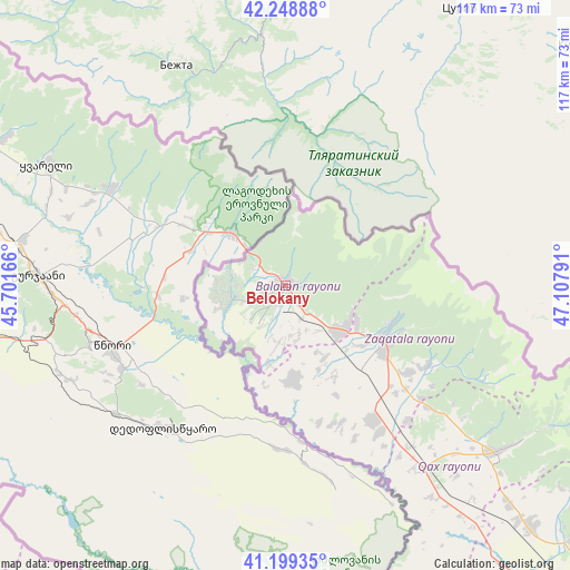
Belokany GPS coordinates[2]
41° 43' 34.536" North, 46° 24' 17.208" East
| Map corner | latitude | longitude |
|---|---|---|
| Upper-left | 42.24888°, | 45.70166° |
| Center: | 41.72626°, | 46.40478° |
| Lower-right: | 41.19935°, | 47.10791° |
| Map W x H: | 116.7×116.7 km | = 72.5×72.5mi |
| max Lat: | 41.75259° ⇑0.5% North |
| Belokany: | 41.72626° |
| min Lat: | ⇓99.5% South 38.45598° |
| min Long | Belokany | max Long |
| 44.84846° | 46.40478° | 50.84003° |
| W 24.9%⇐ | ⇒75.1% E |
Elevation
Elevation of Belokany is 372 m = 1220 ft, and this is 11 m = 36 ft below average elevation for this country.
| Max E: |
2211 m = 7254 ft | 38.4% |
| Avg. | 383 m = 1257 ft | |
| Belokany | 372 m = 1220 ft | |
Min E: |
-26 m = -85 ft | 61.6% |
See also: Azerbaijan elevation on elevation.city.
Geographical zone
Belokany is located in North temperate zone (between Tropic of Cancer and the Arctic Circle). Distance of this Northern Tropic circle is 2033.6 km =1263.6 mi to South.| Distance of | km | miles | from Belokany |
|---|---|---|---|
| North Pole | 5367.5 | 3335.2 | to North |
| Arctic Circle | 2761.6 | 1716 | to North |
| Tropic Cancer | 2033.6 | 1263.6 | to South |
| Equator | 4639.5 | 2882.9 | to South |


Nearby cities:
15 places around Belokany: (largest is in red/bold)
• Aliabad
33.1 km =20.6 mi,  144°
144°
• Baş Göynük
73.9 km =45.9 mi,  127°
127°
• Dolyar
100.9 km =62.7 mi,  197°
197°
• Faldarlı
30.1 km =18.7 mi,  162°
162°
• Mamrux
36.4 km =22.6 mi,  124°
124°
• Qabaqçöl
11.5 km =7.1 mi,  284°
284°
• Qandax
30.1 km =18.7 mi, 157°
• Qaraxanlı
98.3 km =61.1 mi,  219°
219°
• Qax
54.9 km =34.1 mi, 128°
• Qax İngiloy
55.7 km =34.6 mi, 127°
• Qaxbaş
56.9 km =35.4 mi, 125°
• Qırmızı Samux
87.5 km =54.4 mi,  181°
181°
• Sheki
87.2 km =54.2 mi, 132°
• Zaqatala
22.5 km =14 mi, 117°
• Çinarlı
51.2 km =31.8 mi, 123°
Sources, notices
• [Note1] Compared only with cities in Azerbaijan existing in our database
• [Src1] Map data: © OpenStreetMap contributors (CC-BY-SA)
• [Src2] Other city data from geonames.org with taken over terms of usage.
• [Src3] Geographical zone / Annual Mean Temperature by Robert A. Rohde @ Wikipedia
